Mosque nearby مسجد
Saudi Arabia
Mosque nearby مسجد
مسجد
3455, Al Khaleel Bin Ahmad, 14724, Riyadh, SA Saudi Arabia
contacts phone
:
+966
Latitude:
24.5375347
, Longitude:
46.7028547
larger map & directions
read more
nearest Mosque
3 m
مسجد حي بدر الجنوبي
3376 ADH Dhaymaran, Riyadh
Mosque
read more
348 m
مصلى البجادي
الخليل بن أحمد،، الرياض
Mosque
read more
412 m
Saleh Al Oqaili Grand Mosque
7414 Al Khalifah Al Mamoon, Riyadh
Mosque
read more
441 m
مسجد محمد بن عبدالوهاب
Musa Al Hajawi, Riyadh
Mosque
read more
515 m
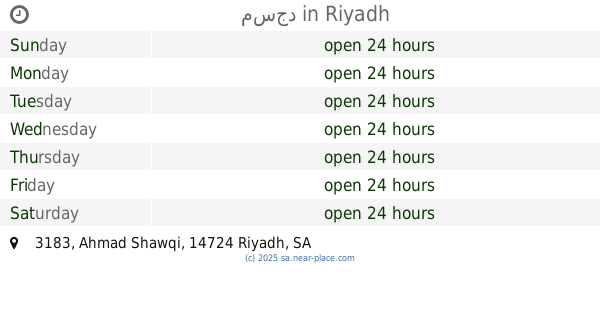
مسجد
3183 Ahmad Shawqi, Riyadh
Mosque
read more
557 m
مسجد هيا بنت عبد العزيز السلمان
4005 الحمضة, Riyadh
Mosque
read more
557 m
هيا بنت عبد العزيز السلمان
شارع الرساله - الشفا، الرياض
Mosque
read more
563 m
مسجد عبد الله بن إبراهيم النقية
بدر،, Riyadh
Mosque
read more
623 m
Masjid
Ayn Abdullah, Riyadh
Mosque
read more
636 m
Masjid مسجد
Hazm Al Qaiyah, Riyadh
Mosque
read more
721 m
Abdullah Al Atiq Mosque
As Salimi, Riyadh
Mosque
read more
742 m
مسجد جامع سعود بن فهد
7716 Al Qadi Al Mariy, Riyadh
Mosque
read more
882 m
Southern Badr Mosque
Al Jabarti, Riyadh
Mosque
read more
899 m
جامع عبدالرحمن محمد الجريوي
2595 وثيلان, Riyadh
Mosque
read more
967 m
مسجد الصحابة بحي بدر
2486 As Sahabah, Badr Riyadh 14724 7063 As Sahabah, Riyadh
Mosque
read more
1.03 km
Majid Al-Sheikh mosque
Al Ashraf, Riyadh
Mosque
read more
1.126 km
جامع العبداللطيف
Badr
Mosque
read more
1.14 km
جامع الصحابي الجليل علي بن أبي طالب رضي الله عنه
7967 Al Jaid Ibn Ash Shammakh, Riyadh
Mosque
read more
1.146 km
مسجد عبدالله بن مبارك
Badr
Mosque
read more
1.167 km
مسجد
7744 مدرك بن واصل، بدر الرياض 14724 4364 Mudrak Ibn Wasil, Riyadh
Mosque
read more
1.18 km
Amr ibn al-Aas mosque
Wadi Zamzam, Riyadh
Mosque
read more
1.207 km
مسجد مصعب بن عمير
Badr
Mosque
read more
1.223 km
مسجد حي بدر ( الثاني )
4162 Al Imam Malik Road, Riyadh
Mosque
read more
1.228 km
Noaamh Mosque
8885 نويعمة, Riyadh
Mosque
read more
1.28 km
جامع محمد الجويعد
Badr
Mosque
read more
📑
all categories
Accounting
Administrative area level 1
Airport
Amusement park
Aquarium
Art gallery
Atm
Bakery
Bank
Bar
Beauty salon
Bicycle store
Book store
Bowling alley
Bus station
Cafe
Campground
Car dealer
Car rental
Car repair
Car wash
Casino
Cemetery
Church
City hall
Clothing store
Colloquial area
Convenience store
Country
Courthouse
Dentist
Department store
Doctor
Electrician
Electronics store
Embassy
Finance
Fire station
Florist
Food
Funeral home
Furniture store
Gas station
General contractor
Grocery or supermarket
Gym
Hair care
Hardware store
Health
Hindu Temple
Home goods store
Hospital
Insurance agency
Intersection
Jewelry store
Laundry
Lawyer
Library
Light rail station
Liquor store
Local government office
Locality
Locksmith
Lodging
Meal delivery
Meal takeaway
Mosque
Movie rental
Movie theater
Moving company
Museum
Natural feature
Neighborhood
Night club
Painter
Park
Parking
Pet store
Pharmacy
Physiotherapist
Place of worship
Plumber
Point of interest
Police
Political
Post office
Premise
Real estate agency
Restaurant
Roofing contractor
Route
Rv park, camping
School
Shoe store
Shopping mall
Spa
Stadium
Storage
Store
Sublocality
Subpremise
Subway station
Supermarket
Taxi stand
Train station
Transit station
Travel agency
University
Veterinary care
Zoo
sublocality level 1
↑