Mosque nearby مسجد ابي الدرداء
Saudi Arabia
Mosque nearby مسجد ابي الدرداء
مسجد ابي الدرداء
مخطط الرواف،، Al Rawaf Planning, Buraydah 52388 3400, Saudi Arabia
contacts phone
:
+966
Latitude:
26.4028411
, Longitude:
43.9294787
larger map & directions
read more
nearest Mosque
8 m
Al Nahdah Mosque
Uthman Ibn Affan Road, Buraydah
Mosque
read more
347 m
Al Humaidan Mosque
Buraydah
Mosque
read more
371 m
مسجد عبدالله الراشد الحميد
Al Rawaf Planning, Buraydah
Mosque
read more
411 m
مسجد علي الفايزي
3535, مخطط الرواف 6698, Buraydah
Mosque
read more
428 m
Jarir Ibn Abdullah Al Bajali Mosque
Uthman Ibn Affan Road, مخطط الرواف، 3182, Buraydah
Mosque
read more
462 m
مسجد العضيب
6721 Uthman Ibn Affan Road, مخطط الرواف, Buraydah
Mosque
read more
488 m
Al Waldain Mosque
مخطط الرواف،, Buraydah
Mosque
read more
493 m
الشيخ عبدالرحمن العقل
Buraydah
Mosque
read more
505 m
Ibn ِAl Qayyim Grand Mosque
Buraydah
Mosque
read more
539 m
Thu Al Nourayn Mosque
Buraydah
Mosque
read more
546 m
Al Mudaifer Mosque
Umar Ibn Al Khatab Road, Buraydah
Mosque
read more
666 m
Noura Bint Ibrahim Al Omairi Mosque
7461, الجامعيين، 3916, Buraydah
Mosque
read more
667 m
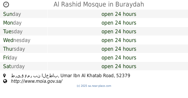
Al Rashid Mosque
طريق عمر بن الخطاب Umar Ibn Al Khatab Road, مخطط الرواف،, Buraydah
Mosque
read more
683 m
Al Hussain Mosque
مخطط الرواف، 5383, Buraydah
Mosque
read more
696 m
مسجد علو الهمة
Buraydah
Mosque
read more
725 m
مسجد ابن كثير
3218, مخطط الرواف, Buraydah
Mosque
read more
729 m
Al Ajaji Mosque
Umar Ibn Al Khatab Road, مخطط الرواف, Buraydah
Mosque
read more
733 m
مسجد محمد الفايزي
طريق أبو بكر الصديق،، بريدة
Mosque
read more
791 m
Al Omayrini Mosque
2949, مخطط الرواف, Buraydah
Mosque
read more
799 m
Algliqh Mosque
6285, Buraydah
Mosque
read more
823 m
Obaidan Mosque
Umar Ibn Al Khatab Road, Buraydah
Mosque
read more
844 m
Al Odhaib Mosque
6543, 4044, Buraydah
Mosque
read more
873 m
ِAl Moqaiteeb Mosque
Buraydah
Mosque
read more
874 m
Al Saleem Grand Mosque
3266, مخطط الرواف, Buraydah
Mosque
read more
880 m
مسجد ابو ريتاج
Buraydah
Mosque
read more
📑
all categories
Accounting
Administrative area level 1
Airport
Amusement park
Aquarium
Art gallery
Atm
Bakery
Bank
Bar
Beauty salon
Bicycle store
Book store
Bowling alley
Bus station
Cafe
Campground
Car dealer
Car rental
Car repair
Car wash
Casino
Cemetery
Church
City hall
Clothing store
Colloquial area
Convenience store
Country
Courthouse
Dentist
Department store
Doctor
Electrician
Electronics store
Embassy
Finance
Fire station
Florist
Food
Funeral home
Furniture store
Gas station
General contractor
Grocery or supermarket
Gym
Hair care
Hardware store
Health
Hindu Temple
Home goods store
Hospital
Insurance agency
Intersection
Jewelry store
Laundry
Lawyer
Library
Light rail station
Liquor store
Local government office
Locality
Locksmith
Lodging
Meal delivery
Meal takeaway
Mosque
Movie rental
Movie theater
Moving company
Museum
Natural feature
Neighborhood
Night club
Painter
Park
Parking
Pet store
Pharmacy
Physiotherapist
Place of worship
Plumber
Point of interest
Police
Political
Post office
Premise
Real estate agency
Restaurant
Roofing contractor
Route
Rv park, camping
School
Shoe store
Shopping mall
Spa
Stadium
Storage
Store
Sublocality
Subpremise
Subway station
Supermarket
Taxi stand
Train station
Transit station
Travel agency
University
Veterinary care
Zoo
sublocality level 1
↑