Mosque nearby مسجد محطة الحماد
Saudi Arabia
Mosque nearby مسجد محطة الحماد
مسجد محطة الحماد
Khamis Mushait 62458 4716, Arabia Saudita
contacts phone
:
+966
Latitude:
18.3342025
, Longitude:
42.731803
larger map & directions
read more
nearest Mosque
159 m
مسجد الإمام الذهبي
شارع الثمانين، حي الجوازات، خميس مشيط
Mosque
read more
159 m
مسجد الامام الذهبي
Khamis Mushait
Mosque
read more
159 m
مسجد الامام الذهبي
Chamis Muszajt
Mosque
read more
377 m
Nawaz
Khamis Mushait
Mosque
read more
386 m
مسجد عائشة بنت عامر
Khamis Mushait
Mosque
read more
466 m
مسجد أم ناصر
النهضة، خميس مشيط
Mosque
read more
499 m
جامع
Khamis Mushait
Mosque
read more
529 m
Osama Bin Zaid Mosque
Khamis Mushait
Mosque
read more
627 m
مسجد عباد الرحمن
4245, Khamis Mushait
Mosque
read more
946 m
مسجد
حي شباعة، خميس مشيط
Mosque
read more
1.015 km
مسجد مربع الخير
Khamis Mushait
Mosque
read more
1.02 km
Vegetable market Mosque
7027, 2478, Khamis Mushait
Mosque
read more
1.039 km
Saeed Bin Hmbes Mosque
Khamis Mushait
Mosque
read more
1.042 km
مسجد
حي الراقي، خميس مشيط
Mosque
read more
1.075 km
مصلى العيد بالحي الراقي
Khamis Mushait
Mosque
read more
1.083 km
مسجد رحمة البريدي
Khamis Mushait
Mosque
read more
1.09 km
مصلى العيد الجديد
Chamis Muszajt
Mosque
read more
1.09 km
مصلى العيد الجديد
Khamis Mushait
Mosque
read more
1.149 km
Abu Bakr Mosque
Khamis Mushait
Mosque
read more
1.172 km
مسجد
طريق الستين, حي شباعة، خميس مشيط
Mosque
read more
1.18 km
مسجد غفرة صالح آل راسي
طريق الصناعية، خميس مشيط
Mosque
read more
1.242 km
Saeed bin Abdullah mosque Zubairi and his mother
Khamis Mushait
Mosque
read more
1.319 km
مسجد البيان
طريق وادي بن هشبل، خميس مشيط
Mosque
read more
1.405 km
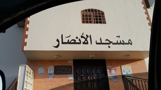
مسجد الأنصار
Shubaah
Mosque
read more
1.408 km
مسجد الأنصار
طريق ابو بكر الصديق, حي شباعة، خميس مشيط
Mosque
read more
📑
all categories
Accounting
Administrative area level 1
Airport
Amusement park
Aquarium
Art gallery
Atm
Bakery
Bank
Bar
Beauty salon
Bicycle store
Book store
Bowling alley
Bus station
Cafe
Campground
Car dealer
Car rental
Car repair
Car wash
Casino
Cemetery
Church
City hall
Clothing store
Colloquial area
Convenience store
Country
Courthouse
Dentist
Department store
Doctor
Electrician
Electronics store
Embassy
Finance
Fire station
Florist
Food
Funeral home
Furniture store
Gas station
General contractor
Grocery or supermarket
Gym
Hair care
Hardware store
Health
Hindu Temple
Home goods store
Hospital
Insurance agency
Intersection
Jewelry store
Laundry
Lawyer
Library
Light rail station
Liquor store
Local government office
Locality
Locksmith
Lodging
Meal delivery
Meal takeaway
Mosque
Movie rental
Movie theater
Moving company
Museum
Natural feature
Neighborhood
Night club
Painter
Park
Parking
Pet store
Pharmacy
Physiotherapist
Place of worship
Plumber
Point of interest
Police
Political
Post office
Premise
Real estate agency
Restaurant
Roofing contractor
Route
Rv park, camping
School
Shoe store
Shopping mall
Spa
Stadium
Storage
Store
Sublocality
Subpremise
Subway station
Supermarket
Taxi stand
Train station
Transit station
Travel agency
University
Veterinary care
Zoo
sublocality level 1
↑