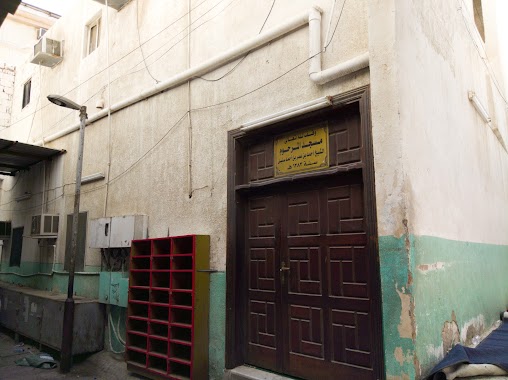
Mosque nearby مسجد و جامع بن محفوظ
Saudi Arabia
Mosque nearby مسجد و جامع بن محفوظ
مسجد و جامع بن محفوظ
Al Bukayri, Jeddah Saudi Arabia
contacts phone
:
+966
Latitude:
21.482448
, Longitude:
39.1914672
read more
nearest Mosque
147 m
مسجد الشيخ أحمد بن عمر بن أحمد سنبل
6532 Shaqqar, Al Balad District, Jeddah 22238
Mosque
read more
168 m
مسجد النخلة
6481 سعادي، حي البلد جدة 22238
Mosque
read more
176 m
مسجد فاعل خير
6458 النصائف، حي البلد جدة 22238
Mosque
read more
190 m
مسجد البقسماطي
3508 حلقة الطيور, Al Balad District, Jeddah
Mosque
read more
214 m
Bab Sharif Mosque
3406 الخيمه, حي البلد, Jeddah
Mosque
read more
270 m
مسجد بشيبش
3815 زقاق الشراع, حي البلد، 6831،, Jeddah
Mosque
read more
296 m
مسجد أبو شال
6432 As Suwayq, حي البلد،, Jeddah
Mosque
read more
304 m
مسجد الهندي
3922 اهل البناء, حي البلد، 6563،, Jeddah
Mosque
read more
307 m
مسجد النور
Al Noor Mosque, Rakha Al Islam, Jeddah
Mosque
read more
312 m
مسجد الشيخ علي
3508 زقاق وادي الزوحاء، حي البلد، جدة 22238
Mosque
read more
319 m
مسجد ابن تيمية
6410 As Suwayq, حي البلد،, Jeddah
Mosque
read more
329 m
مسجد جامع قرية الغوانمة
Al Qunfudhah, Jeddah
Mosque
read more
333 m
مسجد الرحمة
3459 وادي الشاله، حي البلد جدة 22238
Mosque
read more
349 m
مسجد زاوية الفتن
6640 Sallam Ln, Al Balad District, Jeddah 22236
Mosque
read more
350 m
Shamoon Mosque
6419 As Sawt, حي البلد،, Jeddah
Mosque
read more
350 m
مسجد شمعون
6419 As Sawt, حي البلد،, Jeddah
Mosque
read more
365 m
مسجد
6352 قريه العش، حي البلد جدة 22238
Mosque
read more
382 m
مسجد بلال بن رباح
Jeddah
Mosque
read more
398 m
مسجد عبدالحق
3810 الفيصل، حي البلد جدة 22238
Mosque
read more
401 m
Masjid-e-Noor
6284 Wadi Ash Shalah, حي البلد, Jeddah
Mosque
read more
414 m
مسجد مصعب بن عمير
4033 Dar As Sabil, حي البلد، 6736،, Jeddah
Mosque
read more
417 m
Masjid al tawbah
Old Makkah Road, Jeddah
Mosque
read more
424 m
Almaghrabi Masjid
3417 Suq Al Alawi, Jeddah
Mosque
read more
443 m
زاوية حسوبة
Jeddah
Mosque
read more
458 m
مسجد قاسم
3376 حبونه، حي البلد، جدة 22238
Mosque
read more
📑
all categories
Accounting
Administrative area level 1
Airport
Amusement park
Aquarium
Art gallery
Atm
Bakery
Bank
Bar
Beauty salon
Bicycle store
Book store
Bowling alley
Bus station
Cafe
Campground
Car dealer
Car rental
Car repair
Car wash
Casino
Cemetery
Church
City hall
Clothing store
Colloquial area
Convenience store
Country
Courthouse
Dentist
Department store
Doctor
Electrician
Electronics store
Embassy
Finance
Fire station
Florist
Food
Funeral home
Furniture store
Gas station
General contractor
Grocery or supermarket
Gym
Hair care
Hardware store
Health
Hindu Temple
Home goods store
Hospital
Insurance agency
Intersection
Jewelry store
Laundry
Lawyer
Library
Light rail station
Liquor store
Local government office
Locality
Locksmith
Lodging
Meal delivery
Meal takeaway
Mosque
Movie rental
Movie theater
Moving company
Museum
Natural feature
Neighborhood
Night club
Painter
Park
Parking
Pet store
Pharmacy
Physiotherapist
Place of worship
Plumber
Point of interest
Police
Political
Post office
Premise
Real estate agency
Restaurant
Roofing contractor
Route
Rv park, camping
School
Shoe store
Shopping mall
Spa
Stadium
Storage
Store
Sublocality
Subpremise
Subway station
Supermarket
Taxi stand
Train station
Transit station
Travel agency
University
Veterinary care
Zoo
sublocality level 1
↑