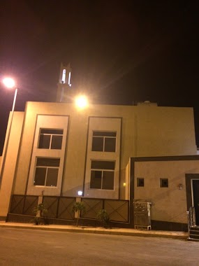
Mosque nearby Musab bin Omair Mosque neighborhood Hussam
Saudi Arabia
Mosque nearby Musab bin Omair Mosque neighborhood Hussam
Musab bin Omair Mosque neighborhood Hussam
8050, Khamis Mushait Saudi Arabia
contacts phone
:
+966
Latitude:
18.3116891
, Longitude:
42.6886771
read more
nearest Mosque
234 m
Nora Mosque
4142 7837 حي حسام, Khamis Mushait
Mosque
read more
248 m
مسجد البكري
3892, 8238, Khamis Mushait
Mosque
read more
301 m
مسجد
الحسام، خميس مشيط
Mosque
read more
336 m
مسجد التهامي ALTUHAMI MASJED
Al Yamamah, Khamis Mushait
Mosque
read more
445 m
مسجد الشبلي
7582, 4183,, Khamis Mushait
Mosque
read more
541 m
Mosque Imam Muslim
Khamis Mushait
Mosque
read more
544 m
مسجد دار الإيمان
Khamis Mushait
Mosque
read more
676 m
مسجد الرحمة
حي حسام، خميس مشيط
Mosque
read more
696 m
Sheikh Hussein bin Sultan Hassania Mosque and his wife Aisha Al Dajm
8626, Khamis Mushait
Mosque
read more
760 m
Salah al-Din Mosque
Khamis Mushait
Mosque
read more
781 m
جامع المنارات
Khamis Mushait
Mosque
read more
787 m
مسجد الحديقة
Khamis Mushait
Mosque
read more
827 m
Masjid
4635, Khamis Mushait
Mosque
read more
828 m
مسجد التوبة
7266, Khamis Mushait
Mosque
read more
858 m
Zaina Ali al Hussaini Mosque
7251, Khamis Mushait
Mosque
read more
880 m
مسجد البر
Khamis Mushait
Mosque
read more
943 m
جامع الطبري
حي حسام، خميس مشيط
Mosque
read more
954 m
Masjid
Khamis Mushait
Mosque
read more
974 m
Mosque of Ibn Taymiyyah
Khamis Mushait
Mosque
read more
1.003 km
المسجد
التحلية
Mosque
read more
1.024 km
مسجد ابن معيض بحضن القلوص
5040, Khamis Mushait
Mosque
read more
1.024 km
جامع ذي النورين
Khamis Mushait
Mosque
read more
1.04 km
مسجد الشلال
شارع الشلال، حي حسام، خميس مشيط
Mosque
read more
1.049 km
جامع الريحان
Khamis Mushait
Mosque
read more
1.115 km
Collector campus colloidal
8896 طريق المحالة، القافلة، خميس مشيط 62454 4768 Al Mahalah Road, Khamis Mushait
Mosque
read more
📑
all categories
Accounting
Administrative area level 1
Airport
Amusement park
Aquarium
Art gallery
Atm
Bakery
Bank
Bar
Beauty salon
Bicycle store
Book store
Bowling alley
Bus station
Cafe
Campground
Car dealer
Car rental
Car repair
Car wash
Casino
Cemetery
Church
City hall
Clothing store
Colloquial area
Convenience store
Country
Courthouse
Dentist
Department store
Doctor
Electrician
Electronics store
Embassy
Finance
Fire station
Florist
Food
Funeral home
Furniture store
Gas station
General contractor
Grocery or supermarket
Gym
Hair care
Hardware store
Health
Hindu Temple
Home goods store
Hospital
Insurance agency
Intersection
Jewelry store
Laundry
Lawyer
Library
Light rail station
Liquor store
Local government office
Locality
Locksmith
Lodging
Meal delivery
Meal takeaway
Mosque
Movie rental
Movie theater
Moving company
Museum
Natural feature
Neighborhood
Night club
Painter
Park
Parking
Pet store
Pharmacy
Physiotherapist
Place of worship
Plumber
Point of interest
Police
Political
Post office
Premise
Real estate agency
Restaurant
Roofing contractor
Route
Rv park, camping
School
Shoe store
Shopping mall
Spa
Stadium
Storage
Store
Sublocality
Subpremise
Subway station
Supermarket
Taxi stand
Train station
Transit station
Travel agency
University
Veterinary care
Zoo
sublocality level 1
↑