Mosque nearby Musfer Masjid
Saudi Arabia
Mosque nearby Musfer Masjid
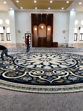
Musfer Masjid
King Saud Road, Dammam Saudi Arabia
contacts phone
:
+966
Latitude:
26.3889468
, Longitude:
50.1797855
read more
nearest Mosque
434 m
Abdullah Aldabal Mosque
3600, 7610, Dammam
Mosque
read more
435 m
مركز عبدالله الدبل الاسلامي
3600, 7610, Dammam
Mosque
read more
704 m
مسجد سعد الوهيبي
3379 King Saud Rd As Safa Dammam 34222 7331 King Saud Road, Dammam
Mosque
read more
850 m
مسجد علي بن ابي طالب رضي الله عنه
8722 طريق الملك فيصل، الصفا الدمام 34221
Mosque
read more
910 m
Safa Mosque
7255, Dammam
Mosque
read more
1.195 km
University Mosque
Dammam
Mosque
read more
1.301 km
مسجد الرضوان
Dammam
Mosque
read more
1.304 km
مسجد الفرقان
Dammam
Mosque
read more
1.313 km
Khaled Aldabal Mosque
Dammam
Mosque
read more
1.313 km
Khaled Aldabal Masjid
Dammam
Mosque
read more
1.375 km
مسجد سليمان الشارخ رحمه الله
6881, Dammam
Mosque
read more
1.641 km
Masjid
6397 King Saud Road, Dammam
Mosque
read more
1.736 km
Masjid Fatma
Alqasim Alkhawarizmi Street, Dammam
Mosque
read more
1.744 km
مسجد الإخلاص
9144 Abu Al Qasim Al Amadi, Dammam
Mosque
read more
1.826 km
مسجد باعظيم
Abdulrazaq Bin Hammam Street, Dammam
Mosque
read more
1.911 km
جامع السكن
7656, Dammam
Mosque
read more
1.97 km
Alsaeed Mosque
Dammam
Mosque
read more
2.254 km
Taibah Mosque
Dammam
Mosque
read more
2.278 km
Ayed Hussain Al-Qahtani Mosque
Dammam
Mosque
read more
2.285 km
Student housing Mosque
Dammam
Mosque
read more
2.33 km
Majed Al-Harthy Mosque
4651, Dammam
Mosque
read more
2.449 km
Masjid Al Khalawi Center
Dammam
Mosque
read more
2.478 km
Al Bayan Mosque
Dammam
Mosque
read more
2.5 km
Abdullah Bin Abi Quhafa Mosque
Dammam
Mosque
read more
2.516 km
مسجد عبدالله بن أبي قحافة
3898 البحتري, Dammam
Mosque
read more
📑
all categories
Accounting
Administrative area level 1
Airport
Amusement park
Aquarium
Art gallery
Atm
Bakery
Bank
Bar
Beauty salon
Bicycle store
Book store
Bowling alley
Bus station
Cafe
Campground
Car dealer
Car rental
Car repair
Car wash
Casino
Cemetery
Church
City hall
Clothing store
Colloquial area
Convenience store
Country
Courthouse
Dentist
Department store
Doctor
Electrician
Electronics store
Embassy
Finance
Fire station
Florist
Food
Funeral home
Furniture store
Gas station
General contractor
Grocery or supermarket
Gym
Hair care
Hardware store
Health
Hindu Temple
Home goods store
Hospital
Insurance agency
Intersection
Jewelry store
Laundry
Lawyer
Library
Light rail station
Liquor store
Local government office
Locality
Locksmith
Lodging
Meal delivery
Meal takeaway
Mosque
Movie rental
Movie theater
Moving company
Museum
Natural feature
Neighborhood
Night club
Painter
Park
Parking
Pet store
Pharmacy
Physiotherapist
Place of worship
Plumber
Point of interest
Police
Political
Post office
Premise
Real estate agency
Restaurant
Roofing contractor
Route
Rv park, camping
School
Shoe store
Shopping mall
Spa
Stadium
Storage
Store
Sublocality
Subpremise
Subway station
Supermarket
Taxi stand
Train station
Transit station
Travel agency
University
Veterinary care
Zoo
sublocality level 1
↑