Mosque nearby Sheikh Abdullah bin Misfer Mosque
Saudi Arabia
Mosque nearby Sheikh Abdullah bin Misfer Mosque
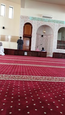
Sheikh Abdullah bin Misfer Mosque
8796, خالد بن الوليد, 62521, Abha, SA Arabia Saudita
contacts phone
:
+966
Latitude:
18.224836
, Longitude:
42.4960613
larger map & directions
read more
nearest Mosque
159 m
Albahot Mosque
2900, Abha
Mosque
read more
260 m
جامع الصفيح الأعلى بأبها
8590، القابل، أبها 62521
Mosque
read more
303 m
Omar bin al-Khattab mosque Balord
9123, Abha
Mosque
read more
329 m
مسجد خيرية بنت عطية بن عبدالله
أبها
Mosque
read more
392 m
مسجد البشري
Abha
Mosque
read more
455 m
Grand Mosque Al-Mosalah
King Faisal Road, Abha
Mosque
read more
465 m
مسجد أبي موسى الأشعري
حي الوردتين، أبها
Mosque
read more
482 m
مسجد محمد بن عبدالوهاب
Abha
Mosque
read more
482 m
جامع محمد بن عبدالوهاب
Abha
Mosque
read more
503 m
Ihsan Mosque
Abha
Mosque
read more
576 m
مسجد
King Faisal Road, Abha
Mosque
read more
588 m
مسجد حصن ابها التراثي
3112, Abha
Mosque
read more
602 m
Al Raya Mosque
Abha
Mosque
read more
652 m
Masjid Al-Attar
Al Riyadh, Abha
Mosque
read more
713 m
Mosque Mosque
King Faisal Road, Abha
Mosque
read more
824 m
مسجد السلام
Abha
Mosque
read more
830 m
جامع النور
Unnamed Road, Abha
Mosque
read more
839 m
Shamsan Mosque
Abha
Mosque
read more
853 m
مسجد الأميرة العنود
Shamasan
Mosque
read more
859 m
جامع الملك فيصل رحمه الله
Ring Road, Abha
Mosque
read more
861 m
مسجد المحطة
أبها
Mosque
read more
865 m
King Faisal Grand Mosque
Ring Road, Abha
Mosque
read more
888 m
Masjid Al-Salam neighborhood Othman
2416, Abha
Mosque
read more
906 m
جامع ناصر القحطاني
Abha
Mosque
read more
906 m
جامع لبنان
Al Riyadh, Abha
Mosque
read more
📑
all categories
Accounting
Administrative area level 1
Airport
Amusement park
Aquarium
Art gallery
Atm
Bakery
Bank
Bar
Beauty salon
Bicycle store
Book store
Bowling alley
Bus station
Cafe
Campground
Car dealer
Car rental
Car repair
Car wash
Casino
Cemetery
Church
City hall
Clothing store
Colloquial area
Convenience store
Country
Courthouse
Dentist
Department store
Doctor
Electrician
Electronics store
Embassy
Finance
Fire station
Florist
Food
Funeral home
Furniture store
Gas station
General contractor
Grocery or supermarket
Gym
Hair care
Hardware store
Health
Hindu Temple
Home goods store
Hospital
Insurance agency
Intersection
Jewelry store
Laundry
Lawyer
Library
Light rail station
Liquor store
Local government office
Locality
Locksmith
Lodging
Meal delivery
Meal takeaway
Mosque
Movie rental
Movie theater
Moving company
Museum
Natural feature
Neighborhood
Night club
Painter
Park
Parking
Pet store
Pharmacy
Physiotherapist
Place of worship
Plumber
Point of interest
Police
Political
Post office
Premise
Real estate agency
Restaurant
Roofing contractor
Route
Rv park, camping
School
Shoe store
Shopping mall
Spa
Stadium
Storage
Store
Sublocality
Subpremise
Subway station
Supermarket
Taxi stand
Train station
Transit station
Travel agency
University
Veterinary care
Zoo
sublocality level 1
↑