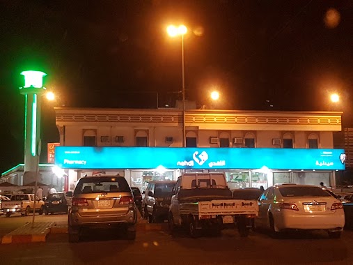
Pharmacy nearby Albandar Pharmacy
Coronavirus disease (COVID-19) Situation
confirmed cases
841469
deaths
9646
Saudi Arabia
Pharmacy nearby Albandar Pharmacy
Albandar Pharmacy
2201, Bahrah, Jeddah 22824, Saudi Arabia
contacts phone
:
+966
Latitude:
21.3992468
, Longitude:
39.4396034
larger map & directions
read more
nearest Pharmacy
7 m
Western medicine pharmacy
290, Bahrah
Pharmacy
read more
99 m
صيدلية غاية
Bahrah
Pharmacy
read more
107 m
صيدلية غاية بحرة 1
290, Bahrah
Pharmacy
read more
398 m
صيدلية غاية
2557, Jeddah
Pharmacy
read more
850 m
Nahdi Pharmacy
290, Bahrah
Pharmacy
read more
865 m
صيدلية المجاهدين
Bahrah
Pharmacy
read more
891 m
صيدلية حفصة حسون غندورة
بحرة المجاهدين، جدة
Pharmacy
read more
4.958 km
صيدلية المستقبل البيطرية
Pharmacy
read more
5.292 km
Pharmacy extremely Bahra 3
4742, Jeddah
Pharmacy
read more
6.524 km
Nahdi
6733, Jeddah
Pharmacy
read more
6.696 km
Al Awwad Pharmacy
Makkah - Jeddah Highway, Mecca
Pharmacy
read more
6.881 km
صيدلية المجتمع المتطورة 3
المحاميد أمام صراف الراجحى
Pharmacy
read more
6.972 km
صيدلية
المحاميد
Pharmacy
read more
9.494 km
صيدلية بيطرية
290, Hadda
Pharmacy
read more
10.426 km
صيدلية الجرعة الطبية
4311, حي الفضل 7687, Jeddah
Pharmacy
read more
10.433 km
صيدلية الجرعه الطبيه .العليا
4311, حي الفضل 7687, Jeddah
Pharmacy
read more
11.314 km
صيدلية العطاء الحديثة
طريق الحرازات, Jeddah
Pharmacy
read more
11.431 km
النهدي
Jeddah
Pharmacy
read more
11.443 km
Dan Medical Pharmacy 22
Jeddah
Pharmacy
read more
11.569 km
Dan Pharmacy ( Nahdi )
طريق الحرازات
Pharmacy
read more
12.212 km
صيدلية غاية
4630, Hadda
Pharmacy
read more
12.874 km
El Mujtama Evolving Pharmacy 2
طريق الحرازات, Jeddah
Pharmacy
read more
13.268 km
صيدلية المصادر المتطورة
Al Jumum - Hada Road, Hadda
Pharmacy
read more
13.287 km
Nahdi Pharmacy
4383, Al Ajaweed District, Jeddah
Pharmacy
read more
13.695 km
AL THAMOOD PHARMACY 2
3520, Um Asalam District, Jeddah
Pharmacy
read more
📑
all categories
Accounting
Administrative area level 1
Airport
Amusement park
Aquarium
Art gallery
Atm
Bakery
Bank
Bar
Beauty salon
Bicycle store
Book store
Bowling alley
Bus station
Cafe
Campground
Car dealer
Car rental
Car repair
Car wash
Casino
Cemetery
Church
City hall
Clothing store
Colloquial area
Convenience store
Country
Courthouse
Dentist
Department store
Doctor
Electrician
Electronics store
Embassy
Finance
Fire station
Florist
Food
Funeral home
Furniture store
Gas station
General contractor
Grocery or supermarket
Gym
Hair care
Hardware store
Health
Hindu Temple
Home goods store
Hospital
Insurance agency
Intersection
Jewelry store
Laundry
Lawyer
Library
Light rail station
Liquor store
Local government office
Locality
Locksmith
Lodging
Meal delivery
Meal takeaway
Mosque
Movie rental
Movie theater
Moving company
Museum
Natural feature
Neighborhood
Night club
Painter
Park
Parking
Pet store
Pharmacy
Physiotherapist
Place of worship
Plumber
Point of interest
Police
Political
Post office
Premise
Real estate agency
Restaurant
Roofing contractor
Route
Rv park, camping
School
Shoe store
Shopping mall
Spa
Stadium
Storage
Store
Sublocality
Subpremise
Subway station
Supermarket
Taxi stand
Train station
Transit station
Travel agency
University
Veterinary care
Zoo
sublocality level 1
↑