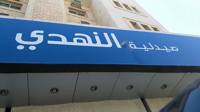
Pharmacy nearby النهدي
Saudi Arabia
Pharmacy nearby النهدي
النهدي
Khaleej Road, Dammam Saudi Arabia
contacts phone
:
+966
Latitude:
26.458639
, Longitude:
50.0867252
read more
nearest Pharmacy
598 m
Life Pharmacy
Dammam
Pharmacy
read more
646 m
Al-Dawaa
6249 Abu Hurairah Street, Dammam
Pharmacy
read more
788 m
al balsam al-teby pharmacy
شارع أبو هريرة، الدمام
Pharmacy
read more
894 m
Nahdi
Khaleej Road, Dammam
Pharmacy
read more
993 m
aldawa pharmacy | صيدلة الدواء
شارع الزخرف, Dammam
Pharmacy
read more
1.025 km
Gulf Health Pharmacy
Dammam
Pharmacy
read more
1.119 km
Nahdi
شارع عبد العزيز، حي الخلج، الدمام
Pharmacy
read more
1.145 km
Al-Dawaa
18th Street, Dammam
Pharmacy
read more
1.175 km
صيدلية أكسجين الحياة
6965 Abu Hurairah Street, Dammam
Pharmacy
read more
1.175 km
صيدلية أكسجين الحياة
6965 Abu Hurairah St، Dammam
Pharmacy
read more
1.231 km
صيدلية شريف ٨
Dammam
Pharmacy
read more
1.286 km
Nahdi
18th Street, Dammam
Pharmacy
read more
1.329 km
صيدلية أهل الرعاية
7163 Abu Hurairah Street, Dammam
Pharmacy
read more
1.388 km
Nahdi
King Abdulaziz Street, Dammam
Pharmacy
read more
1.421 km
صيدلية الحياة
شارع 28، بجانب بنك الأهلي، حي الخليج، الدمام
Pharmacy
read more
1.44 km
الحياة
28th Street, Dammam
Pharmacy
read more
1.689 km
DAWAA PHARMACY
18th Street, Dammam
Pharmacy
read more
1.743 km
Maakal Aldawa Pharmacy
King Abdulaziz Street, Dammam
Pharmacy
read more
1.911 km
صيدلية الريان المتميزة
شارع الملك سعود، حي الخليج، الدمام
Pharmacy
read more
1.963 km
صيدلية نور الدواء
3411 Ibn Asaker, Dammam
Pharmacy
read more
1.98 km
Adama Pharmacy
Dammam
Pharmacy
read more
2.011 km
صيدلية ابن حيان
شارع الثامن والعشرون ، شارع المزارع، الدمام
Pharmacy
read more
2.015 km
Sondos Life Pharmacy
King Saud Street, Dammam
Pharmacy
read more
2.14 km
صيدلية الجامعة رقم 4
Dammam
Pharmacy
read more
2.176 km
Boots
دارين مول، طريق الخليج، صفا، الدمام
Pharmacy
read more
📑
all categories
Accounting
Administrative area level 1
Airport
Amusement park
Aquarium
Art gallery
Atm
Bakery
Bank
Bar
Beauty salon
Bicycle store
Book store
Bowling alley
Bus station
Cafe
Campground
Car dealer
Car rental
Car repair
Car wash
Casino
Cemetery
Church
City hall
Clothing store
Colloquial area
Convenience store
Country
Courthouse
Dentist
Department store
Doctor
Electrician
Electronics store
Embassy
Finance
Fire station
Florist
Food
Funeral home
Furniture store
Gas station
General contractor
Grocery or supermarket
Gym
Hair care
Hardware store
Health
Hindu Temple
Home goods store
Hospital
Insurance agency
Intersection
Jewelry store
Laundry
Lawyer
Library
Light rail station
Liquor store
Local government office
Locality
Locksmith
Lodging
Meal delivery
Meal takeaway
Mosque
Movie rental
Movie theater
Moving company
Museum
Natural feature
Neighborhood
Night club
Painter
Park
Parking
Pet store
Pharmacy
Physiotherapist
Place of worship
Plumber
Point of interest
Police
Political
Post office
Premise
Real estate agency
Restaurant
Roofing contractor
Route
Rv park, camping
School
Shoe store
Shopping mall
Spa
Stadium
Storage
Store
Sublocality
Subpremise
Subway station
Supermarket
Taxi stand
Train station
Transit station
Travel agency
University
Veterinary care
Zoo
sublocality level 1
↑