Pharmacy nearby Colgate Palmolive Dammam
Saudi Arabia
Pharmacy nearby Colgate Palmolive Dammam
Colgate Palmolive Dammam
11, 11 Street, 32234, Dammam, SA Saudi Arabia
contacts phone
:
+966
Latitude:
26.3889462
, Longitude:
50.1493887
larger map & directions
read more
nearest Pharmacy
1.32 km
مستودع سنابل الدواء
Dammam
Pharmacy
read more
1.64 km
Mzn bodycare مزن للعناية بالبشرة
4066 ابن البيطار, Dammam
Pharmacy
read more
2.484 km
Gulf Income Trading Warehouse
Aktham Ibn Saifi Street, Dammam
Pharmacy
read more
2.769 km
Alsaidi Factory
2 Street, 27, Dammam
Pharmacy
read more
2.9 km
Al-Dawaa
Aktham Ibn Saifi St, Dammam
Pharmacy
read more
2.93 km
Daan Al Taif Pharmacy
Dammam
Pharmacy
read more
2.978 km
AFI Chemicals Warehouse
4484 الحارث بن كلدة, Dammam
Pharmacy
read more
3.071 km
Shore Waves Trading Est. Facility
Unnamed Road, Dammam
Pharmacy
read more
3.168 km
صيدلية مرجان
Dhahran
Pharmacy
read more
3.204 km
صيدلية مزايا الدواء
Dhahran
Pharmacy
read more
3.319 km
Al-Dawaa
Sahil Street, Dhahran
Pharmacy
read more
3.328 km
صيدلية الدواء
Sahil Street, Dammam
Pharmacy
read more
3.431 km
صيدلية ترياق الشفاء
Dammam
Pharmacy
read more
3.434 km
Boots Pharmacy
3rd Floor, Othaim Mall, Al Khansa'a St., Abdullah Fuad, Dammam
Pharmacy
read more
3.741 km
Al-Dawaa
4468 Prince Metib Road, Dammam
Pharmacy
read more
3.993 km
Al-Dawaa
Fatema Al Zahra Street, Dammam
Pharmacy
read more
3.993 km
Al-hayah
Fatema Al Zahra Street, Dammam
Pharmacy
read more
4.001 km
صيدلية الحياة
شارع فاطمة الزهراء، حي عبدالله فؤاد، الدمام
Pharmacy
read more
4.02 km
Al-Dawaa
King Saud Road, Dammam
Pharmacy
read more
4.233 km
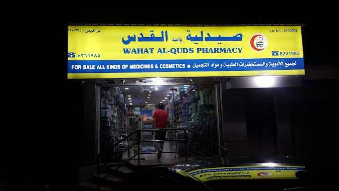
Pharmacy Oasis Jerusalem
Dammam
Pharmacy
read more
4.254 km
alkods Pharmacy
شارع 16، حي عبد الله فؤاد، الدمام
Pharmacy
read more
4.254 km
alkods Pharmacy
16 Street, Dammam
Pharmacy
read more
4.27 km
Al Mana Pharmacy
Dammam
Pharmacy
read more
4.327 km
صيدلية الدواء
2775 فاطمة الزهراء, Dammam
Pharmacy
read more
4.399 km
Nahdi Pharmacy
Dammam
Pharmacy
read more
📑
all categories
Accounting
Administrative area level 1
Airport
Amusement park
Aquarium
Art gallery
Atm
Bakery
Bank
Bar
Beauty salon
Bicycle store
Book store
Bowling alley
Bus station
Cafe
Campground
Car dealer
Car rental
Car repair
Car wash
Casino
Cemetery
Church
City hall
Clothing store
Colloquial area
Convenience store
Country
Courthouse
Dentist
Department store
Doctor
Electrician
Electronics store
Embassy
Finance
Fire station
Florist
Food
Funeral home
Furniture store
Gas station
General contractor
Grocery or supermarket
Gym
Hair care
Hardware store
Health
Hindu Temple
Home goods store
Hospital
Insurance agency
Intersection
Jewelry store
Laundry
Lawyer
Library
Light rail station
Liquor store
Local government office
Locality
Locksmith
Lodging
Meal delivery
Meal takeaway
Mosque
Movie rental
Movie theater
Moving company
Museum
Natural feature
Neighborhood
Night club
Painter
Park
Parking
Pet store
Pharmacy
Physiotherapist
Place of worship
Plumber
Point of interest
Police
Political
Post office
Premise
Real estate agency
Restaurant
Roofing contractor
Route
Rv park, camping
School
Shoe store
Shopping mall
Spa
Stadium
Storage
Store
Sublocality
Subpremise
Subway station
Supermarket
Taxi stand
Train station
Transit station
Travel agency
University
Veterinary care
Zoo
sublocality level 1
↑