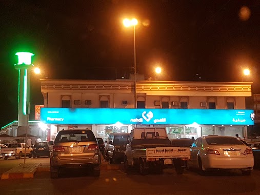
Pharmacy nearby Drug Pharmacy Jeddah
Saudi Arabia
Pharmacy nearby Drug Pharmacy Jeddah
Drug Pharmacy Jeddah
حي الاجاويد، Jeddah 22442 8779, Saudi Arabia
contacts phone
:
+966
website:
www.al-dawaa.com
Latitude:
21.4120346
, Longitude:
39.2894637
larger map & directions
read more
nearest Pharmacy
204 m
Nahdi
3199, Al Ajaweed District 8916, Jeddah
Pharmacy
read more
205 m
صيدلية النهدي
3199, Al Ajaweed District 8916, Jeddah
Pharmacy
read more
945 m
Nahdi
Al Ajaweed Street, Near Jama Al Ajaweed، جدة
Pharmacy
read more
1.012 km
Pharmacy Crystal 12
حى الأجاويد - الشارع العام, Jeddah
Pharmacy
read more
1.019 km
صيدلية جوهرة الكريستال
حى الأجاويد - الشارع العام, Jeddah
Pharmacy
read more
1.325 km
Sudais Pharmacy ( Nahdi )
قلب الجزيره, Jeddah
Pharmacy
read more
1.329 km
Sudais Pharmacy 8
9342, حي الاجاويد،, Jeddah
Pharmacy
read more
1.502 km
صيدلية اطلس
7335, حي الاجاويد 3365, Jeddah
Pharmacy
read more
1.613 km
صيدلية النهدي -حي السنابل
Jeddah
Pharmacy
read more
1.62 km
Nahdi Pharmacy
Jeddah
Pharmacy
read more
1.877 km
Al Zahra Ideal Pharmacyصيدلية الزهراء المثالية
Jeddah
Pharmacy
read more
1.895 km
تلال الغروب الاسكان
Unnamed Road, Jeddah
Pharmacy
read more
1.995 km
Nahdi
Sayed Al-Shuhada'a, Jeddah
Pharmacy
read more
2.009 km
Al Neam Pharmacy
2772, Al Amir Fawaz Al Janouby District, Jeddah
Pharmacy
read more
2.047 km
Future Pharmacy
3935, Jeddah
Pharmacy
read more
2.053 km
Future Health Pharmacy 9
3893, 7593, Jeddah
Pharmacy
read more
2.104 km
Asia Modern Pharmacy
Jeddah
Pharmacy
read more
2.235 km
Al-Nada Pharmacy 5
Jeddah
Pharmacy
read more
2.289 km
Dan Taif Pharmacy ( Nahdi)
Jeddah
Pharmacy
read more
2.393 km
Al-Dawaa
3943, حي الهدى, Jeddah
Pharmacy
read more
2.463 km
Jawaher Pharmacy
قلب الجزيره, Jeddah
Pharmacy
read more
2.622 km
صيدلية المجتمع
4063, حي الهدى, Jeddah
Pharmacy
read more
2.729 km
صيدلية اسيا
3067, Jeddah
Pharmacy
read more
2.775 km
Nahdi Pharmacy
4383, Al Ajaweed District, Jeddah
Pharmacy
read more
2.905 km
صيدلية مستقبل الصحة 6
Jeddah
Pharmacy
read more
📑
all categories
Accounting
Administrative area level 1
Airport
Amusement park
Aquarium
Art gallery
Atm
Bakery
Bank
Bar
Beauty salon
Bicycle store
Book store
Bowling alley
Bus station
Cafe
Campground
Car dealer
Car rental
Car repair
Car wash
Casino
Cemetery
Church
City hall
Clothing store
Colloquial area
Convenience store
Country
Courthouse
Dentist
Department store
Doctor
Electrician
Electronics store
Embassy
Finance
Fire station
Florist
Food
Funeral home
Furniture store
Gas station
General contractor
Grocery or supermarket
Gym
Hair care
Hardware store
Health
Hindu Temple
Home goods store
Hospital
Insurance agency
Intersection
Jewelry store
Laundry
Lawyer
Library
Light rail station
Liquor store
Local government office
Locality
Locksmith
Lodging
Meal delivery
Meal takeaway
Mosque
Movie rental
Movie theater
Moving company
Museum
Natural feature
Neighborhood
Night club
Painter
Park
Parking
Pet store
Pharmacy
Physiotherapist
Place of worship
Plumber
Point of interest
Police
Political
Post office
Premise
Real estate agency
Restaurant
Roofing contractor
Route
Rv park, camping
School
Shoe store
Shopping mall
Spa
Stadium
Storage
Store
Sublocality
Subpremise
Subway station
Supermarket
Taxi stand
Train station
Transit station
Travel agency
University
Veterinary care
Zoo
sublocality level 1
↑