Pharmacy nearby صيدلية المدلوح
Saudi Arabia
Pharmacy nearby صيدلية المدلوح
صيدلية المدلوح
Al Kawthar, Saihat 32431, Saudi Arabia
contacts phone
:
+966
Latitude:
26.4824391
, Longitude:
50.0541649
larger map & directions
read more
nearest Pharmacy
183 m
Nahdi
Khaleej Road, Saihat
Pharmacy
read more
662 m
Dawaa 386
Khaleej Rd Khaleej Road, Saihat
Pharmacy
read more
667 m
Al-Dawaa
Saihat
Pharmacy
read more
790 m
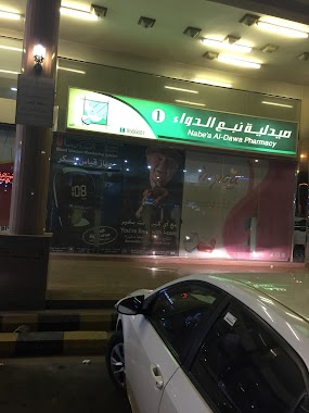
صيدلية نبع الدواء 1
King Abdulaziz Road, Saihat
Pharmacy
read more
856 m
صيدلية نبع الدواء
سيهات
Pharmacy
read more
885 m
Exceer Pharmacy
Saihat
Pharmacy
read more
885 m
Pharmacy Elixir 7
Saihat
Pharmacy
read more
1.103 km
Nahdi
King Abdulaziz Road, Saihat
Pharmacy
read more
1.279 km
Eshrakat Al Sabah Pharmacy
Ibn Khaldun, Saihat
Pharmacy
read more
1.288 km
Almudallouh Pharmacy
7690 عمر بن عبد العزيز, 4371, Saihat
Pharmacy
read more
1.351 km
Al-Dawaa
Omar Ibn Abdulaziz Street, Saihat
Pharmacy
read more
1.353 km
صيدلية الدواء فرع سيهات 116
Saihat
Pharmacy
read more
1.413 km
مجمع الربان - حي الفردوس
7315 Abu Alnas'r Alhussaini, 4602,, Saihat
Pharmacy
read more
1.601 km
Al Reda Pharmacy
Abu Musa Alansari Street, Saihat
Pharmacy
read more
1.64 km
مؤسسة حسين الشايب
Saihat
Pharmacy
read more
1.696 km
Al Hayat Pharmacy
البحيرة مول، الدمام
Pharmacy
read more
1.712 km
صيدلية اشراقة الصباح
2966 Abu Musa Alansari Street, Saihat
Pharmacy
read more
2.29 km
Almohanna Pharmacy
2666 ابراهيم الشاطبي, المنتزه, المنطقة الشرقية, Saihat
Pharmacy
read more
2.589 km
Boots
دارين مول، طريق الخليج، صفا، الدمام
Pharmacy
read more
2.6 km
Adama Pharmacy
Dammam
Pharmacy
read more
2.631 km
Boots Pharmacy
Dareen Mall Dammam, Dammam
Pharmacy
read more
2.704 km
Gozal Pharmacy صيدلية جوزل
3418 King Abdulaziz Road, Dammam
Pharmacy
read more
2.722 km
صيدلية الدواء
8255 عمر بن عبد العزيز, Dammam
Pharmacy
read more
2.732 km
Aldawaa Pharmacy
8255 عمر بن عبد العزيز، الدمام
Pharmacy
read more
3.174 km
Nahdi
5074 شارع الملك عبد العزيز، حي المحمدية، الدمام
Pharmacy
read more
📑
all categories
Accounting
Administrative area level 1
Airport
Amusement park
Aquarium
Art gallery
Atm
Bakery
Bank
Bar
Beauty salon
Bicycle store
Book store
Bowling alley
Bus station
Cafe
Campground
Car dealer
Car rental
Car repair
Car wash
Casino
Cemetery
Church
City hall
Clothing store
Colloquial area
Convenience store
Country
Courthouse
Dentist
Department store
Doctor
Electrician
Electronics store
Embassy
Finance
Fire station
Florist
Food
Funeral home
Furniture store
Gas station
General contractor
Grocery or supermarket
Gym
Hair care
Hardware store
Health
Hindu Temple
Home goods store
Hospital
Insurance agency
Intersection
Jewelry store
Laundry
Lawyer
Library
Light rail station
Liquor store
Local government office
Locality
Locksmith
Lodging
Meal delivery
Meal takeaway
Mosque
Movie rental
Movie theater
Moving company
Museum
Natural feature
Neighborhood
Night club
Painter
Park
Parking
Pet store
Pharmacy
Physiotherapist
Place of worship
Plumber
Point of interest
Police
Political
Post office
Premise
Real estate agency
Restaurant
Roofing contractor
Route
Rv park, camping
School
Shoe store
Shopping mall
Spa
Stadium
Storage
Store
Sublocality
Subpremise
Subway station
Supermarket
Taxi stand
Train station
Transit station
Travel agency
University
Veterinary care
Zoo
sublocality level 1
↑