Pharmacy nearby صيدلية دان المجد
Saudi Arabia
Pharmacy nearby صيدلية دان المجد
صيدلية دان المجد
Tuwaiq, Riyadh 14936, Saudi Arabia
contacts phone
:
+966
Latitude:
24.5526919
, Longitude:
46.5726593
larger map & directions
read more
nearest Pharmacy
657 m
صيدلية أصداء الراحة
Saudi, Riyadh
Pharmacy
read more
1.296 km
صيدلية علاجكم
الرياض
Pharmacy
read more
1.478 km
Mathalat aldawaa pharmacy 6
Riyadh
Pharmacy
read more
1.483 km
صيدلية مظلة الدواء
شارع علي بن الشيبان، الرياض
Pharmacy
read more
1.494 km
صيدلية مظلة الدواء ٦
Riyadh
Pharmacy
read more
1.853 km
صيدليه الدواء المتكامل
Riyadh
Pharmacy
read more
2.018 km
صيدلية قمة الدواء
طريق نجم الدين الأيوبي، الرياض
Pharmacy
read more
2.021 km
Pharmacy joy of life
Riyadh
Pharmacy
read more
2.614 km
صيدلية يوم الدواء
Riyadh
Pharmacy
read more
2.737 km
Jewels of Hope Pharmacy
2090 Jubbah, Riyadh
Pharmacy
read more
2.812 km
صيدلية الرضا
2309 Bilal Ibn Rabah, Riyadh
Pharmacy
read more
2.812 km
صيدلية موارد الدواء
شارع احمد بن الخطاب، حي طويق، الرياض
Pharmacy
read more
2.814 km
صيدليه موارد الدواء ٣
حي الموسى، طويق،, Riyadh
Pharmacy
read more
2.824 km
موارد الدواء
حي الموسى طويق،, Riyadh
Pharmacy
read more
2.833 km
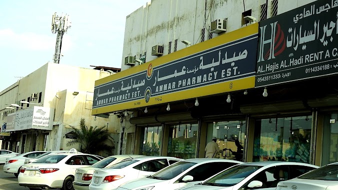
صيدلية مؤسسة عمار
2391 Bilal Ibn Rabah, Riyadh
Pharmacy
read more
2.834 km
Al-Dawaa
3469 Bilal Ibn Rabah Tuwaiq Riyadh 14922 6716 Bilal Ibn Rabah, Riyadh
Pharmacy
read more
2.838 km
Medicine Rose Pharmacy
Al Qashshashiyya, Riyadh
Pharmacy
read more
2.847 km
Charisma Pharmacy 2
Riyadh
Pharmacy
read more
2.858 km
صيدلية كاريزما
3644 Bilal Ibn Rabah, Tuwaiq, Riyadh 14922 6767 Bilal Ibn Rabah, Riyadh
Pharmacy
read more
2.86 km
صيدلية مجد الدواء
Riyadh
Pharmacy
read more
2.864 km
أستر الدواء
Sulayman Ibn Abdulmalik Ibn Marwan, Riyadh
Pharmacy
read more
2.864 km
Aster Al dawaa pharmacy
4, 24°34'02. 46°32'55.5"E, Riyadh
Pharmacy
read more
2.88 km
صيدلية نور الصحة
طريق المدينة المنورة - حي طويق، الرياض
Pharmacy
read more
2.926 km
صيدلية خالد العرفج
شارع بلال بن رباح، حي طويق، الرياض
Pharmacy
read more
2.954 km
صيدلية المتحدة
شارع بلال بن رباح، حي طويق، الرياض
Pharmacy
read more
📑
all categories
Accounting
Administrative area level 1
Airport
Amusement park
Aquarium
Art gallery
Atm
Bakery
Bank
Bar
Beauty salon
Bicycle store
Book store
Bowling alley
Bus station
Cafe
Campground
Car dealer
Car rental
Car repair
Car wash
Casino
Cemetery
Church
City hall
Clothing store
Colloquial area
Convenience store
Country
Courthouse
Dentist
Department store
Doctor
Electrician
Electronics store
Embassy
Finance
Fire station
Florist
Food
Funeral home
Furniture store
Gas station
General contractor
Grocery or supermarket
Gym
Hair care
Hardware store
Health
Hindu Temple
Home goods store
Hospital
Insurance agency
Intersection
Jewelry store
Laundry
Lawyer
Library
Light rail station
Liquor store
Local government office
Locality
Locksmith
Lodging
Meal delivery
Meal takeaway
Mosque
Movie rental
Movie theater
Moving company
Museum
Natural feature
Neighborhood
Night club
Painter
Park
Parking
Pet store
Pharmacy
Physiotherapist
Place of worship
Plumber
Point of interest
Police
Political
Post office
Premise
Real estate agency
Restaurant
Roofing contractor
Route
Rv park, camping
School
Shoe store
Shopping mall
Spa
Stadium
Storage
Store
Sublocality
Subpremise
Subway station
Supermarket
Taxi stand
Train station
Transit station
Travel agency
University
Veterinary care
Zoo
sublocality level 1
↑