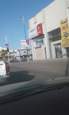
Pharmacy nearby صيدلية صالح
Coronavirus disease (COVID-19) Situation
confirmed cases
841469
deaths
9646
Saudi Arabia
Pharmacy nearby صيدلية صالح
صيدلية صالح
2219 ابو بكر الصديق, Hail Saudi Arabia
contacts phone
:
+966
Latitude:
27.515043
, Longitude:
41.6977334
read more
nearest Pharmacy
2 m
صيدلية الرخيص
2219 ابو بكر الصديق, Hail
Pharmacy
read more
8 m
صيدلية صالح
5618 بغداد, Hail
Pharmacy
read more
54 m
Valley bee
2245 ابو بكر الصديق, 8370, Hail
Pharmacy
read more
71 m
صيدلية الجمييل
حائل
Pharmacy
read more
108 m
صيدلية الزامل
Hail
Pharmacy
read more
132 m
صيدلية دبي
2315 ابو بكر الصديق،, 8363, Hail
Pharmacy
read more
154 m
Aljamaen Medical Pharmacy
2341 ابو بكر الصديق, Hail
Pharmacy
read more
161 m
Dar Al Dawa
Hail
Pharmacy
read more
372 m
Saqqaf Pharmacy
2520 Muhammad Al Abdullah Ar Rashid, Hail
Pharmacy
read more
597 m
صيدلية النهدي
حائل
Pharmacy
read more
681 m
صيدلية ارض الدواء
الملك خالد، حائل
Pharmacy
read more
705 m
مؤسسة جود الريان فرع 2 حليبات اطفال
Al-Imam Muhammad Ibn Saud, Hail
Pharmacy
read more
801 m
صيدلية ابن سينا
Al-Imam Muhammad Ibn Saud, Hail
Pharmacy
read more
884 m
مجموعة صيدليات الدوائية
4339-4449 الإمام محمد بن سعود،
Pharmacy
read more
917 m
صيدلية الدواء
الإمام محمد بن سعود Al-Imam Muhammad Ibn Saud, Hail
Pharmacy
read more
985 m
صيدلية دليل العلاج
5032 Ad Dammam, Hail
Pharmacy
read more
1.012 km
Almuhihi
2440 King Faisal Road, Hail
Pharmacy
read more
1.018 km
Saqqaf Pharmacy
5223 Uqdah Road, Hail
Pharmacy
read more
1.112 km
صيدلية التخصيص ٢
Hail
Pharmacy
read more
1.138 km
Pharmacy Pharmaceutical
الامير مقرن بن عبدالعزيز Al Amir Miqrin Ibn Abdul Aziz, Hail
Pharmacy
read more
1.185 km
Altakhses Pharmacy
5402 King Faisal Road, Hail
Pharmacy
read more
1.262 km
صيدلية السقاف
3944 الإمام محمد بن سعود 55421
Pharmacy
read more
1.321 km
صيدلية الؤلؤه
Hail
Pharmacy
read more
1.369 km
Diyar Hail Pharmacy
6553 King Abdulaziz Road, Hail
Pharmacy
read more
1.391 km
Zamzam Pharmacy
الملك فيصل، حائل
Pharmacy
read more
📑
all categories
Accounting
Administrative area level 1
Airport
Amusement park
Aquarium
Art gallery
Atm
Bakery
Bank
Bar
Beauty salon
Bicycle store
Book store
Bowling alley
Bus station
Cafe
Campground
Car dealer
Car rental
Car repair
Car wash
Casino
Cemetery
Church
City hall
Clothing store
Colloquial area
Convenience store
Country
Courthouse
Dentist
Department store
Doctor
Electrician
Electronics store
Embassy
Finance
Fire station
Florist
Food
Funeral home
Furniture store
Gas station
General contractor
Grocery or supermarket
Gym
Hair care
Hardware store
Health
Hindu Temple
Home goods store
Hospital
Insurance agency
Intersection
Jewelry store
Laundry
Lawyer
Library
Light rail station
Liquor store
Local government office
Locality
Locksmith
Lodging
Meal delivery
Meal takeaway
Mosque
Movie rental
Movie theater
Moving company
Museum
Natural feature
Neighborhood
Night club
Painter
Park
Parking
Pet store
Pharmacy
Physiotherapist
Place of worship
Plumber
Point of interest
Police
Political
Post office
Premise
Real estate agency
Restaurant
Roofing contractor
Route
Rv park, camping
School
Shoe store
Shopping mall
Spa
Stadium
Storage
Store
Sublocality
Subpremise
Subway station
Supermarket
Taxi stand
Train station
Transit station
Travel agency
University
Veterinary care
Zoo
sublocality level 1
↑