School nearby 25th Intermediate school
Saudi Arabia
School nearby 25th Intermediate school
25th Intermediate school
Al Aziziyah, Hafar Al Batin 39956, Saudi Arabia
contacts phone
:
+966 13 721 0279
Latitude:
28.4528393
, Longitude:
45.9660583
larger map & directions
read more
nearest School
78 m
المدرسة الابتدائيّة الثانية عشر
4284, Hafar Al Batin
School
read more
307 m
دار النور النسائية لتحفيظ القرآن الكريم
Hafar Al Batin
School
read more
307 m
مدرسة النور النسائية لتحفيظ القرآن الكريم
Hafar Al Batin
School
read more
363 m
مدرسة النور لتحفيظ القرآن الكريم
School
read more
525 m
Hamza Bin Abdul Muttalib Primary School
Hafar Al Batin
School
read more
677 m
School Koranic medium
Hafar Al Batin
School
read more
692 m
School King Fahd medium
3581, Hafar Al Batin
School
read more
725 m
Ezz Bin Abdul Salam Intermediate School
Hafar Al Batin
School
read more
729 m
متوسطة الملك فهد
Al Aziziyah
School
read more
730 m
Anas Ibn Malik Primary School
Hafar Al Batin
School
read more
739 m
مدرسة إبن تيمية الإتدائية
3600, Hafar Al Batin
School
read more
741 m
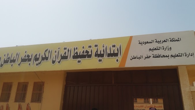
ابتدائية تحفيظ القران
7665, Hafar Al Batin
School
read more
774 m
مدرسة اليرموك المتوسطة
Hafar Al Batin
School
read more
821 m
Medium seventeen
Omar Ibn Al Khattab, Hafar Al Batin
School
read more
833 m
Az Mad
Unnamed Road, Hafar Al Batin
School
read more
837 m
المتوسطة الرابعة والعشرون
7950, Hafar Al Batin
School
read more
837 m
الابتدائية الخامسة والستون
7950, Hafar Al Batin
School
read more
841 m
المتوسطه الرابعه والعشرون والابتدائيه الخامسه والستون
Hafar Al Batin
School
read more
847 m
دار خولة لتحفيظ القرآن الكريم
Hafar Al Batin
School
read more
847 m
دار خولة لتحفيظ القرآن الكريم (جمعية برهان)
Hafar Al Batin
School
read more
865 m
الابتدائية الثامنة والعشرون
Al Aziziyah
School
read more
866 m
Salah al-Din Secondary School Ayyubid
Hafar Al Batin
School
read more
873 m
الخدمات العامه
3875 Salahuddin Al Ayyubi, Hafar Al Batin
School
read more
915 m
مدرسة الإمام القرطبي الثانوية
Hafar Al Batin
School
read more
930 m
Secondary Sixteenth
7941, Hafar Al Batin
School
read more
📑
all categories
Accounting
Administrative area level 1
Airport
Amusement park
Aquarium
Art gallery
Atm
Bakery
Bank
Bar
Beauty salon
Bicycle store
Book store
Bowling alley
Bus station
Cafe
Campground
Car dealer
Car rental
Car repair
Car wash
Casino
Cemetery
Church
City hall
Clothing store
Colloquial area
Convenience store
Country
Courthouse
Dentist
Department store
Doctor
Electrician
Electronics store
Embassy
Finance
Fire station
Florist
Food
Funeral home
Furniture store
Gas station
General contractor
Grocery or supermarket
Gym
Hair care
Hardware store
Health
Hindu Temple
Home goods store
Hospital
Insurance agency
Intersection
Jewelry store
Laundry
Lawyer
Library
Light rail station
Liquor store
Local government office
Locality
Locksmith
Lodging
Meal delivery
Meal takeaway
Mosque
Movie rental
Movie theater
Moving company
Museum
Natural feature
Neighborhood
Night club
Painter
Park
Parking
Pet store
Pharmacy
Physiotherapist
Place of worship
Plumber
Point of interest
Police
Political
Post office
Premise
Real estate agency
Restaurant
Roofing contractor
Route
Rv park, camping
School
Shoe store
Shopping mall
Spa
Stadium
Storage
Store
Sublocality
Subpremise
Subway station
Supermarket
Taxi stand
Train station
Transit station
Travel agency
University
Veterinary care
Zoo
sublocality level 1
↑