School nearby المتوسطه ٣٠
Saudi Arabia
School nearby المتوسطه ٣٠
المتوسطه ٣٠
7885, Al Adl Al Waidh, 12643, Riyadh, SA Saudi Arabia
contacts phone
:
+966
Latitude:
24.646944
, Longitude:
46.722755
larger map & directions
read more
nearest School
26 m
المتوسطة الثلاثون للبنات الرياض
Riyadh
School
read more
32 m
30 medium for girls
2709 Al Qarinah, Riyadh
School
read more
40 m
متوسطة 30 للبنات
Al Amal
School
read more
143 m
Medium Mount Twaiq
Al Qarinah, Riyadh
School
read more
266 m
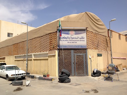
مكتب الدعوة و توعية الجاليات بالبطحاء
Ibn Zahra Ibn Zahra, Riyadh
School
read more
274 m
Islamic Propagation Office Tmpt Jaliat
Al Batha, Riyadh
School
read more
319 m
الغرابية
Unnamed Road, Riyadh
School
read more
388 m
المدرسة الابتدائية 54 للبنات بالرياض
3136 اسد بن الفرات، العمل الرياض 12644 7729 Asad Ibn Al Furat, Riyadh
School
read more
445 m
الادارة العامة للأسلحة والمتفجرات بالأمن العام
Unnamed Road, Riyadh
School
read more
475 m
Fifty-fourth School for Girls
3119 السند, 7561, Riyadh
School
read more
521 m
مدرسة ابن كثير الابتدائية
Al Amal
School
read more
567 m
المدرسة السعودية الابتدائية بالرياض
3488 Ar Rihab, Riyadh
School
read more
577 m
المدرسة السعودية الإبتدائية
7403 Al Farazdaq Road, Riyadh
School
read more
612 m
Islahi Centre- Riyadh, Batha (RICC)
Ar Rail Ar Rail, Riyadh
School
read more
619 m
Salafi Madrasa
2673 Ar Rail, 7267, Riyadh
School
read more
619 m
Salafi Madrasa Riyadh
2673 Ar Rail, 7267, Riyadh
School
read more
674 m
البريد السعودي القديم
Riyadh
School
read more
759 m
Riyadh Indian Islahi Centre
2479 Omar Al Mukhtar, Riyadh
School
read more
950 m
جامع السالميه
شارع،, الرحاب، حي ثليم, Riyadh
School
read more
953 m
IIS-Riyadh
Rawdah At Tanha, Riyadh
School
read more
955 m
International Indian School [Girls Section]
3029 As Safrat, Riyadh
School
read more
1.011 km
مسجد ال معتلي
King Faisal Road, Riyadh
School
read more
1.023 km
School maryam
8844 Al Farazdaq Road, Riyadh
School
read more
1.047 km
البطحاء
2459 ابي أيوب الأنصاري،, 6873, Riyadh
School
read more
1.069 km
دار الكوثر لتحفيظ القرآن الكريم
الرياض
School
read more
📑
all categories
Accounting
Administrative area level 1
Airport
Amusement park
Aquarium
Art gallery
Atm
Bakery
Bank
Bar
Beauty salon
Bicycle store
Book store
Bowling alley
Bus station
Cafe
Campground
Car dealer
Car rental
Car repair
Car wash
Casino
Cemetery
Church
City hall
Clothing store
Colloquial area
Convenience store
Country
Courthouse
Dentist
Department store
Doctor
Electrician
Electronics store
Embassy
Finance
Fire station
Florist
Food
Funeral home
Furniture store
Gas station
General contractor
Grocery or supermarket
Gym
Hair care
Hardware store
Health
Hindu Temple
Home goods store
Hospital
Insurance agency
Intersection
Jewelry store
Laundry
Lawyer
Library
Light rail station
Liquor store
Local government office
Locality
Locksmith
Lodging
Meal delivery
Meal takeaway
Mosque
Movie rental
Movie theater
Moving company
Museum
Natural feature
Neighborhood
Night club
Painter
Park
Parking
Pet store
Pharmacy
Physiotherapist
Place of worship
Plumber
Point of interest
Police
Political
Post office
Premise
Real estate agency
Restaurant
Roofing contractor
Route
Rv park, camping
School
Shoe store
Shopping mall
Spa
Stadium
Storage
Store
Sublocality
Subpremise
Subway station
Supermarket
Taxi stand
Train station
Transit station
Travel agency
University
Veterinary care
Zoo
sublocality level 1
↑