School nearby Amer bin Rabia Primary School
Saudi Arabia
School nearby Amer bin Rabia Primary School
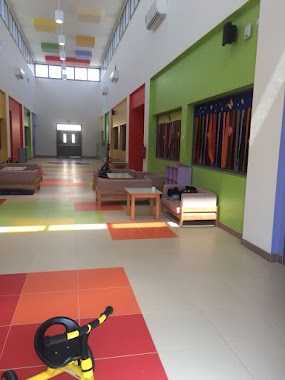
Amer bin Rabia Primary School
3628, Al Hamra and Umm Al Jud, Mecca 24323, Saudi Arabia
contacts phone
:
+966
Latitude:
21.4039503
, Longitude:
39.7079174
larger map & directions
read more
nearest School
26 m
مدرسة عامر بن ربيعة الابتدائية
3628, Mecca
School
read more
41 m
مدرسة عامر بن ربيعة الابتدائية بنين
3628, 6606, Mecca
School
read more
349 m
Zaidy Room
Unnamed Road, Mecca
School
read more
570 m
Suleiman al-Zaidi Secondary School for Boys
Mecca
School
read more
578 m
Abbad ibn Bishr middle school and secondary Suleiman al-Zaidi
Mecca
School
read more
590 m
دار السمو
طريق الامير نايف بن عبدالعزيز،, Mecca
School
read more
667 m
Primary percent and forty-eight girls
Mecca
School
read more
667 m
Yusr international school
Al-takhasosy, Mecca
School
read more
699 m
YUSR International School, Makkah Branch
Al-takhasosy, Mecca
School
read more
778 m
روضة ذات النطاقين
Mekka
School
read more
778 m
روضة ذات النطاقين
Mecca
School
read more
784 m
Seventy-seventh middle school girls
Mecca
School
read more
790 m
المتوسطة السابعة والسبعون بالزايدي بنات
Al Hamra and Umm Al Jud
School
read more
801 m
حضانة أزهار القصر
Mecca
School
read more
825 m
Secondary Ramlet girl Abi Sufyan Girls
Mecca
School
read more
863 m
روضة الكوكب الصغير للإبداع الأهلية
Mecca
School
read more
874 m
مدرسة الاولاد
6800, Mecca
School
read more
927 m
Angel School
Makkah - Jeddah Highway, Mecca
School
read more
927 m
Angel School
Makkah Jeddah Expressway, Mecca
School
read more
978 m
Abdul Rahman Faqih School
Mecca
School
read more
978 m
Abdul Rahman Fakeeh School (AFS)
Mecca
School
read more
988 m
مدارس عبدالرحمن فقيه للبنين
الزايدي، الحمراء وأم الجود،
School
read more
1.574 km
تحفيظ ملتقى الخير
Al-takhasosy, Mecca
School
read more
1.655 km
براعم جيل البيان
خلف ثلاجة المنجم، جوار قاعة بدر للإحتفالات، الزايدي، مكة
School
read more
1.658 km
روضة براعم جيل البيان
Unnamed Road, Mecca
School
read more
📑
all categories
Accounting
Administrative area level 1
Airport
Amusement park
Aquarium
Art gallery
Atm
Bakery
Bank
Bar
Beauty salon
Bicycle store
Book store
Bowling alley
Bus station
Cafe
Campground
Car dealer
Car rental
Car repair
Car wash
Casino
Cemetery
Church
City hall
Clothing store
Colloquial area
Convenience store
Country
Courthouse
Dentist
Department store
Doctor
Electrician
Electronics store
Embassy
Finance
Fire station
Florist
Food
Funeral home
Furniture store
Gas station
General contractor
Grocery or supermarket
Gym
Hair care
Hardware store
Health
Hindu Temple
Home goods store
Hospital
Insurance agency
Intersection
Jewelry store
Laundry
Lawyer
Library
Light rail station
Liquor store
Local government office
Locality
Locksmith
Lodging
Meal delivery
Meal takeaway
Mosque
Movie rental
Movie theater
Moving company
Museum
Natural feature
Neighborhood
Night club
Painter
Park
Parking
Pet store
Pharmacy
Physiotherapist
Place of worship
Plumber
Point of interest
Police
Political
Post office
Premise
Real estate agency
Restaurant
Roofing contractor
Route
Rv park, camping
School
Shoe store
Shopping mall
Spa
Stadium
Storage
Store
Sublocality
Subpremise
Subway station
Supermarket
Taxi stand
Train station
Transit station
Travel agency
University
Veterinary care
Zoo
sublocality level 1
↑