School nearby دار الملقا النسائية
Saudi Arabia
School nearby دار الملقا النسائية
دار الملقا النسائية
الحيرة, 13521, Riyadh, SA Saudi Arabia
contacts phone
:
+966 50 873 1589
Latitude:
24.8039134
, Longitude:
46.6220153
larger map & directions
read more
nearest School
9 m
روضة ورياض أطفال طفل الغد
الحيرة الحيرة, Riyadh
School
read more
422 m
الوليد بن حمدان الملقا
3425 الحوارة، الملقا الرياض 13521
School
read more
872 m
مدارس موسوعة العلوم
الرياض
School
read more
895 m
متوسطة ١٧٧
Al Yasmin Park, No. 134, Riyadh
School
read more
921 m
Preparatory School 201 Sparky's Academy
Riyadh
School
read more
926 m
المدرسة المتوسطة 201
7022 Al Hsi, Riyadh
School
read more
952 m
المدرسة الثانوية 124
7022 Al Hsi, Riyadh
School
read more
961 m
حضانة Almalqa Village Nursery
6701 وادي وج، الملقا، الرياض 13524 3827 Wag Valley, Riyadh
School
read more
964 m
الثانوية ١٢٤
7004 Al Hsi, Riyadh
School
read more
971 m
ثانوية 124
6988 Al Hsi, Riyadh
School
read more
972 m
الابتدائية ٤٠٢ للبنات
3625 Al Umrah, 6933, Riyadh
School
read more
973 m
المتوسطة ٢٠١
7004 Al Hsi, Riyadh
School
read more
1.005 km
الروضة ٣٣
6956 Al Hsi, Riyadh
School
read more
1.019 km
ابتدائية 402
Al Hsi, Riyadh
School
read more
1.074 km
مدرسة اياس بن عدي المتوسطة
Al Hamasah, Riyadh
School
read more
1.077 km
مدارس معالم التربية الأهلية
Mohammed Bin Abdulaziz Aldoghathr, Riyadh
School
read more
1.146 km
مدرسة اوس ابن الارقم
الحسام, Riyadh
School
read more
1.267 km
al breka funiture shop
Mohammed Bin Abdulaziz Aldoghathr, Riyadh
School
read more
1.331 km
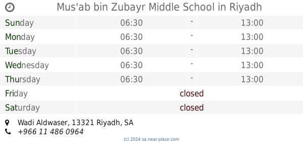
Mus'ab bin Zubayr Middle School
Wadi Aldwaser, Riyadh
School
read more
1.334 km
مدرسة مصعب بن الزبير حي الصحافة
7097 Wadi Aldwaser, Riyadh
School
read more
1.476 km
Ziad Bin Saad Primary School
6744 Wadi Aldwaser, Riyadh
School
read more
1.504 km
Palm Private Schools
Ish Ibn Lubaid, Riyadh
School
read more
1.515 km
البيت
8510 السارة، العقيق، الرياض 13515
School
read more
1.538 km
مدارس الخطوة الاهلية
6617 Rumah, Riyadh
School
read more
1.559 km
الروضة ٧٢ kindergarten72
Riyadh
School
read more
📑
all categories
Accounting
Administrative area level 1
Airport
Amusement park
Aquarium
Art gallery
Atm
Bakery
Bank
Bar
Beauty salon
Bicycle store
Book store
Bowling alley
Bus station
Cafe
Campground
Car dealer
Car rental
Car repair
Car wash
Casino
Cemetery
Church
City hall
Clothing store
Colloquial area
Convenience store
Country
Courthouse
Dentist
Department store
Doctor
Electrician
Electronics store
Embassy
Finance
Fire station
Florist
Food
Funeral home
Furniture store
Gas station
General contractor
Grocery or supermarket
Gym
Hair care
Hardware store
Health
Hindu Temple
Home goods store
Hospital
Insurance agency
Intersection
Jewelry store
Laundry
Lawyer
Library
Light rail station
Liquor store
Local government office
Locality
Locksmith
Lodging
Meal delivery
Meal takeaway
Mosque
Movie rental
Movie theater
Moving company
Museum
Natural feature
Neighborhood
Night club
Painter
Park
Parking
Pet store
Pharmacy
Physiotherapist
Place of worship
Plumber
Point of interest
Police
Political
Post office
Premise
Real estate agency
Restaurant
Roofing contractor
Route
Rv park, camping
School
Shoe store
Shopping mall
Spa
Stadium
Storage
Store
Sublocality
Subpremise
Subway station
Supermarket
Taxi stand
Train station
Transit station
Travel agency
University
Veterinary care
Zoo
sublocality level 1
↑