School nearby متوسطة طيبة
Saudi Arabia
School nearby متوسطة طيبة
متوسطة طيبة
النقع الشرقية،, Buraydah Saudi Arabia
contacts phone
:
+966
Latitude:
26.3697763
, Longitude:
43.9992128
read more
nearest School
30 m
Ibn Rushd High School
7985 An Naqa, Buraydah
School
read more
71 m
ثانوية ابن رشد بنين
7572 An Naqa, Buraydah
School
read more
334 m
ثانوية ابن رشد
Al Rajhi Building # 4, King Khalid Road, 26°22'21.7"N 43°59'54., Buraydah
School
read more
382 m
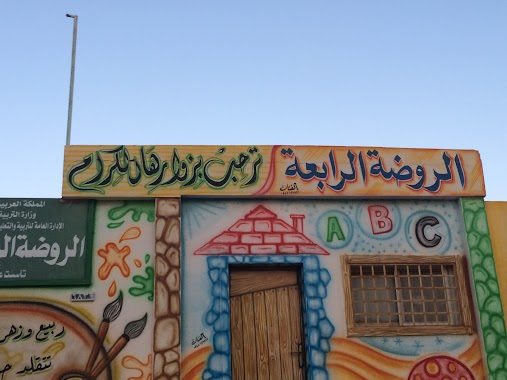
الروضة الحاديه والثلاثون ببريده
2996, 7268, Buraydah
School
read more
423 m
Palestine Elementary School
An Naqa, Buraydah
School
read more
594 m
الابتدائيه التاسعه والخمسون
2719, Buraydah
School
read more
634 m
Tibah Middle School
An Naqa, Buraydah
School
read more
640 m
Mama Madarsha
Unnamed Road, Buraydah
School
read more
644 m
متوسطة طيبة
7104 An Naqa, Buraydah 52368 2819 An Naqa, Buraydah
School
read more
1.199 km
Abu Dijana School
Buraydah
School
read more
1.351 km
37th Elementary School
7466 An Naqa, Buraydah
School
read more
1.521 km
مدارس رياض القصيم الإدارة العامة
6689 طريق الملك فهد، بريدة 52391
School
read more
1.525 km
Riyadh Al Qassim Schools
King Fahd Road, Buraydah
School
read more
1.801 km
مدرسة آثال القصيم
6484 طريق الطرفية، الفايزية بريدة 52391
School
read more
1.818 km
روضة وحضانة اثال القصيم
King Fahd Road, Buraydah
School
read more
1.86 km
Ibn Ishaq Elementary School
6609, 3643, Buraydah
School
read more
2.023 km
مدارس الغد النموذجية بنين
طريق الملك سعود،, Buraydah
School
read more
2.039 km
كلية االادبيه
بريدة
School
read more
2.078 km
4th Elementary School
At Tarafiyyah Road, Buraydah
School
read more
2.081 km
4th Kindergarten
At Tarafiyyah Road, Buraydah
School
read more
2.142 km
Shoabah Bin Ayyash Elementary School
بريدة
School
read more
2.149 km
73rd Elementary School
Prince Sultan Ibn Abdulaziz Road, Buraydah
School
read more
2.155 km
29th Intermediate School
Prince Sultan Ibn Abdulaziz Road, Buraydah
School
read more
2.163 km
Al Aamidi Elementary School
2834, 7352, Buraydah
School
read more
2.192 km
5th High School
3325, 6709, Buraydah
School
read more
📑
all categories
Accounting
Administrative area level 1
Airport
Amusement park
Aquarium
Art gallery
Atm
Bakery
Bank
Bar
Beauty salon
Bicycle store
Book store
Bowling alley
Bus station
Cafe
Campground
Car dealer
Car rental
Car repair
Car wash
Casino
Cemetery
Church
City hall
Clothing store
Colloquial area
Convenience store
Country
Courthouse
Dentist
Department store
Doctor
Electrician
Electronics store
Embassy
Finance
Fire station
Florist
Food
Funeral home
Furniture store
Gas station
General contractor
Grocery or supermarket
Gym
Hair care
Hardware store
Health
Hindu Temple
Home goods store
Hospital
Insurance agency
Intersection
Jewelry store
Laundry
Lawyer
Library
Light rail station
Liquor store
Local government office
Locality
Locksmith
Lodging
Meal delivery
Meal takeaway
Mosque
Movie rental
Movie theater
Moving company
Museum
Natural feature
Neighborhood
Night club
Painter
Park
Parking
Pet store
Pharmacy
Physiotherapist
Place of worship
Plumber
Point of interest
Police
Political
Post office
Premise
Real estate agency
Restaurant
Roofing contractor
Route
Rv park, camping
School
Shoe store
Shopping mall
Spa
Stadium
Storage
Store
Sublocality
Subpremise
Subway station
Supermarket
Taxi stand
Train station
Transit station
Travel agency
University
Veterinary care
Zoo
sublocality level 1
↑