School nearby روضة الحوراء زينب بالشاطئ
Saudi Arabia
School nearby روضة الحوراء زينب بالشاطئ
روضة الحوراء زينب بالشاطئ
9 (C) Street, 32617, Tarout, SA Saudi Arabia
contacts phone
:
+966 56 459 3679
Latitude:
26.5620292
, Longitude:
50.0423312
larger map & directions
read more
nearest School
5 m
روضة الحوراء زينب في الشاطئ
9 (C) Street, Tarout
School
read more
544 m
Kindergarten Bell and Bella
7150, Al Qatif
School
read more
631 m
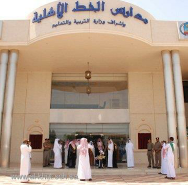
Al-Khut Private School
Tarout
School
read more
667 m
مركز صبا
Abu Thar Alghifari Street, الشاطئ، القطيف
School
read more
669 m
Saba Learning Center
شارع أبو ذر الغفاري Abu Thar Alghifari Street, Al Qatif
School
read more
680 m
مركز روعة التغيير الجديد
Abu Thar Alghifari Street, Al Qatif
School
read more
690 m
دار القرآن
شارع خالد الفرج, Tarout
School
read more
786 m
The first kindergarten in Qatif
20 (C) Street, Al Qatif
School
read more
790 m
Fourth primary school for girls
Abu Thar Alghifari Street, Al Qatif
School
read more
813 m
الثانوية الثالثة بالقطيف
Al Qatif
School
read more
815 m
Child Featured Learning Center
3902, Al Qatif
School
read more
837 m
مركز رونق للدورات التدريبية
4 Street, Tarout
School
read more
842 m
The third high school for girls
20 (C) Street, Al Qatif
School
read more
846 m
مركز روعة التغيير للتدريب النسائي
4 Street, Tarout
School
read more
851 m
Fifth middle school for girls
Alkawthar Street, Al Qatif
School
read more
861 m
Al Qatif School
3804 Al Kawthar, Al Qatif
School
read more
861 m
مدرسة القطيف
6969, Al Qatif
School
read more
925 m
المتوسطة السادسة بالقطيف
Abu Thar Alghifari Street, Al Qatif
School
read more
937 m
المتوسطة السادسة بالقطيف بنات
4894, Al Qatif
School
read more
948 m
Mang Gheng
شارع الأمانة, Tarout
School
read more
950 m
الابتدائية الاثنان والعشرون للبنات
Al Qatif
School
read more
958 m
الروضة الرابعة بالقطيف
Al Qatif
School
read more
959 m
مكتبة
Abu Thar Alghifari Street, Tarout
School
read more
964 m
Mohadia Gumbay
Al Fath, Al Hofuf
School
read more
978 m
الثانوية الأولى بالقديح-السابعة بالقطيف
Al Qatif
School
read more
📑
all categories
Accounting
Administrative area level 1
Airport
Amusement park
Aquarium
Art gallery
Atm
Bakery
Bank
Bar
Beauty salon
Bicycle store
Book store
Bowling alley
Bus station
Cafe
Campground
Car dealer
Car rental
Car repair
Car wash
Casino
Cemetery
Church
City hall
Clothing store
Colloquial area
Convenience store
Country
Courthouse
Dentist
Department store
Doctor
Electrician
Electronics store
Embassy
Finance
Fire station
Florist
Food
Funeral home
Furniture store
Gas station
General contractor
Grocery or supermarket
Gym
Hair care
Hardware store
Health
Hindu Temple
Home goods store
Hospital
Insurance agency
Intersection
Jewelry store
Laundry
Lawyer
Library
Light rail station
Liquor store
Local government office
Locality
Locksmith
Lodging
Meal delivery
Meal takeaway
Mosque
Movie rental
Movie theater
Moving company
Museum
Natural feature
Neighborhood
Night club
Painter
Park
Parking
Pet store
Pharmacy
Physiotherapist
Place of worship
Plumber
Point of interest
Police
Political
Post office
Premise
Real estate agency
Restaurant
Roofing contractor
Route
Rv park, camping
School
Shoe store
Shopping mall
Spa
Stadium
Storage
Store
Sublocality
Subpremise
Subway station
Supermarket
Taxi stand
Train station
Transit station
Travel agency
University
Veterinary care
Zoo
sublocality level 1
↑