Supermarket nearby Star Supermarket Sihat
Saudi Arabia
Supermarket nearby Star Supermarket Sihat
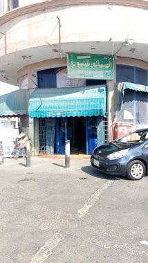
Star Supermarket Sihat
8929, King Abdulaziz Road, Saihat, SA Saudiarabien
contacts phone
:
+966
Latitude:
26.5056474
, Longitude:
50.0298829
larger map & directions
read more
nearest Supermarket
646 m
سكوربيون Scorpion
حي الفيحاء. شارع, Saihat
Supermarket
read more
1.588 km
حلا سيهات
Unnamed Road, Saihat
Supermarket
read more
1.783 km
House Grocery
7270
Supermarket
read more
2.034 km
Sun limits Market Center
7686 Khaleej Road, 3461, Anak
Supermarket
read more
2.101 km
مركز واحة مرحبا
Saihat
Supermarket
read more
2.147 km
Al Muntazah Markets
Ibn As Sibaay, Saihat
Supermarket
read more
2.272 km
فجر للحلويات
5294, Saihat
Supermarket
read more
2.601 km
Rural Food Center
Anak
Supermarket
read more
2.629 km
بنده
Khaleej Road, Saihat
Supermarket
read more
2.629 km
Panda 419
Khaleej Road, Saihat
Supermarket
read more
2.649 km
Al-oraish
Saihat
Supermarket
read more
2.655 km
مجدول للتمور
Anak
Supermarket
read more
3.169 km
Isa'ee Marketing Center
شارع القدس Al Quds Street, Al Qatif
Supermarket
read more
3.322 km
Super Market Zayer
3347, Anak
Supermarket
read more
3.343 km
مزايا الغداء سيهات
شارع الرماة، السلام،, Saihat
Supermarket
read more
3.381 km
Iyad Ahmed Jassas Grocery
Al Qatif
Supermarket
read more
3.452 km
VERCO
شارع القدس Al Quds Street, 7360-, Al Qatif
Supermarket
read more
3.492 km
العضلة الصحيه للمكملات الغذائية
Anak
Supermarket
read more
3.681 km
#فاكهة_الكوثر_خضار_فواكه_تمور
Khaleej Road, Saihat
Supermarket
read more
3.681 km
مؤسسة فاكهة الكوثر
Khaleej Road, Saihat
Supermarket
read more
3.682 km
سوبر ماركت الرضا
Ahmed Shawqi Street, Saihat
Supermarket
read more
3.691 km
Zayer food markets
7104, Anak
Supermarket
read more
3.694 km
Fadak Grocery
7414 كعب الاحباري، سيهات
Supermarket
read more
3.8 km
كريم اهل البيت
6942, Anak
Supermarket
read more
3.895 km
كورنيش الكوثر
Cornish Road, Saihat
Supermarket
read more
📑
all categories
Accounting
Administrative area level 1
Airport
Amusement park
Aquarium
Art gallery
Atm
Bakery
Bank
Bar
Beauty salon
Bicycle store
Book store
Bowling alley
Bus station
Cafe
Campground
Car dealer
Car rental
Car repair
Car wash
Casino
Cemetery
Church
City hall
Clothing store
Colloquial area
Convenience store
Country
Courthouse
Dentist
Department store
Doctor
Electrician
Electronics store
Embassy
Finance
Fire station
Florist
Food
Funeral home
Furniture store
Gas station
General contractor
Grocery or supermarket
Gym
Hair care
Hardware store
Health
Hindu Temple
Home goods store
Hospital
Insurance agency
Intersection
Jewelry store
Laundry
Lawyer
Library
Light rail station
Liquor store
Local government office
Locality
Locksmith
Lodging
Meal delivery
Meal takeaway
Mosque
Movie rental
Movie theater
Moving company
Museum
Natural feature
Neighborhood
Night club
Painter
Park
Parking
Pet store
Pharmacy
Physiotherapist
Place of worship
Plumber
Point of interest
Police
Political
Post office
Premise
Real estate agency
Restaurant
Roofing contractor
Route
Rv park, camping
School
Shoe store
Shopping mall
Spa
Stadium
Storage
Store
Sublocality
Subpremise
Subway station
Supermarket
Taxi stand
Train station
Transit station
Travel agency
University
Veterinary care
Zoo
sublocality level 1
↑