Atm nearby صراف البنك الاهلي التجاري
Saudi Arabia
Atm nearby صراف البنك الاهلي التجاري
صراف البنك الاهلي التجاري
3132-3146, Al Idhaah, 22333, Jeddah, SA Saudi Arabia
contacts phone
:
+966
Latitude:
21.4658165
, Longitude:
39.2093267
larger map & directions
read more
nearest Atm
377 m
SABB
Etha'ah Street, Jeddah
Atm
read more
384 m
ساب
شارع الاذاعة - حي النزلة اليمانية، جدة
Atm
read more
843 m
NCB ATM
شارع الإذاعة، حي القريات، جدة
Atm
read more
856 m
ATM Bank Al Jazira
5133 الفلاح، حي غليل جدة 22413 8906 Al Falah, Jeddah
Atm
read more
900 m
الأهلي
جدة
Atm
read more
916 m
Al Awwal Bank ATM 🏧
Qasr Khuzam, Jeddah
Atm
read more
1.067 km
الأهلي
Jeddah
Atm
read more
1.158 km
صراف ساب
8559 Zaynal, حي غليل, Jeddah
Atm
read more
1.165 km
SABB
Zainal Street TTW Lobby, Jeddah
Atm
read more
1.181 km
صرافة الأهلي
Jeddah
Atm
read more
1.395 km
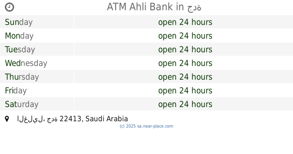
ATM Ahli Bank
جدة
Atm
read more
1.405 km
NCB ATM Effat College
8482 Qasr Khuzam, An Nazlah Al Yamaniyah District, Jeddah 22332 3362 Qasr Khuzam, Jeddah
Atm
read more
1.436 km
Riyad ATM
8334 Al Jaziri, حي غليل،, Jeddah
Atm
read more
1.446 km
البنك السعودي للاستثمار
المحجر، جدة
Atm
read more
1.466 km
Alfransi Atm
Unnamed Road, Jeddah
Atm
read more
1.471 km
صراف البنك الاول🏧
طريق الملك خالد،، جدة
Atm
read more
1.488 km
الأهلي
شارع التلفزيون، حي المحجر، جدة
Atm
read more
1.488 km
NCB ATM
3887 الفلاح، حي بترومين جدة 22413 8902 Al Falah, Jeddah
Atm
read more
1.499 km
Riyad ATM
Al Mahjar, Jeddah
Atm
read more
1.527 km
Riyad ATM🏧
6887 Madain Al Fahd, Madain Al Fahd District, Jeddah 22336 2794 Madain Al Fahd, Jeddah
Atm
read more
1.531 km
Ahli Bank
3887 Al Falah, حي بترومين, Jeddah
Atm
read more
1.576 km
بنك الرياض
مينا مول، شارع المحجر، جدة
Atm
read more
1.601 km
Tahweel Al Rajhi
Al-Eskan, Al-Eskan Al-Janoubi, Jeddah
Atm
read more
1.603 km
تحويل الراجحي
Jeddah
Atm
read more
1.623 km
صراف العربي
4690 Muhammad Harasani, حي غليل, Jeddah
Atm
read more
📑
all categories
Accounting
Administrative area level 1
Airport
Amusement park
Aquarium
Art gallery
Atm
Bakery
Bank
Bar
Beauty salon
Bicycle store
Book store
Bowling alley
Bus station
Cafe
Campground
Car dealer
Car rental
Car repair
Car wash
Casino
Cemetery
Church
City hall
Clothing store
Colloquial area
Convenience store
Country
Courthouse
Dentist
Department store
Doctor
Electrician
Electronics store
Embassy
Finance
Fire station
Florist
Food
Funeral home
Furniture store
Gas station
General contractor
Grocery or supermarket
Gym
Hair care
Hardware store
Health
Hindu Temple
Home goods store
Hospital
Insurance agency
Intersection
Jewelry store
Laundry
Lawyer
Library
Light rail station
Liquor store
Local government office
Locality
Locksmith
Lodging
Meal delivery
Meal takeaway
Mosque
Movie rental
Movie theater
Moving company
Museum
Natural feature
Neighborhood
Night club
Painter
Park
Parking
Pet store
Pharmacy
Physiotherapist
Place of worship
Plumber
Point of interest
Police
Political
Post office
Premise
Real estate agency
Restaurant
Roofing contractor
Route
Rv park, camping
School
Shoe store
Shopping mall
Spa
Stadium
Storage
Store
Sublocality
Subpremise
Subway station
Supermarket
Taxi stand
Train station
Transit station
Travel agency
University
Veterinary care
Zoo
sublocality level 1
↑