Mosque nearby King Abdullah Mosque
Saudi Arabia
Mosque nearby King Abdullah Mosque
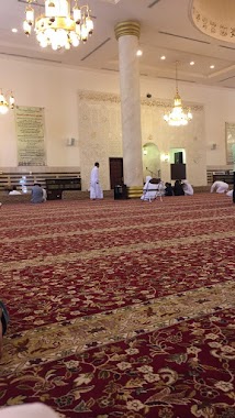
King Abdullah Mosque
8541, Wadi Hail, 23337, Jeddah, SA Saudi Arabia
contacts phone
:
+966
Latitude:
21.5523859
, Longitude:
39.191028
larger map & directions
read more
nearest Mosque
12 m
مسجد خادم الحرمين الشريفين الملك عبدالله بن عبدالعزيز آل سعود
8541 Wadi Hail, حي العزيزية،, Jeddah
Mosque
read more
366 m
مسجد البركة
8908 وادى لؤى، حي العزيزية، جدة 23337
Mosque
read more
386 m
مسجد مضاوي العبد الله الحمدان
8913 وادي السعد، حي العزيزية جدة 23337 3922 Wadi As Saad, Jeddah
Mosque
read more
392 m
Imam Shafi'i mosque
King Fahd Branch Road, Jeddah
Mosque
read more
428 m
Mosque
3745 Khaybar, Al Aziziyah District Jeddah 23337 8118 Khaybar, Jeddah
Mosque
read more
467 m
مسجد الخيرات
شارع وادي نجران، جدة
Mosque
read more
469 m
مسجد الخيرات
3599 وادي نجران، حي العزيزية، جدة 23337
Mosque
read more
492 m
جامع النور
Wadi Al Hilmi, Jeddah
Mosque
read more
589 m
مسجد الملا
3386 Al Fariq, حي العزيزية, Jeddah
Mosque
read more
632 m
مسجد الزبير بن العوام
7945-7946 Dayar Al Balah, Jeddah
Mosque
read more
675 m
Al Taqwa Mosque
3599 Wadi Fatimah, Jeddah
Mosque
read more
691 m
Tawhid Mosque
7972 اطار، حي العزيزية جدة 23337 4158 Itar, Jeddah
Mosque
read more
707 m
مسجد النخيل
العزيزية،, Jeddah
Mosque
read more
729 m
Obeida Amer bin Jarrah mosque
8426 وادي الليث, حي العزيزية،, Jeddah
Mosque
read more
752 m
مسجد عثمان بن عفان
Jabal Antar, Jeddah
Mosque
read more
778 m
Masjid Al Amin
Al Muhandisin, Jeddah
Mosque
read more
818 m
مسجد
Abu Qir, Jeddah
Mosque
read more
825 m
Zahra mosque
Abu Qir, Jeddah
Mosque
read more
834 m
مسجد الخير
Wadi Zamzam, Jeddah
Mosque
read more
835 m
Al-Khair Mosque
9008 القاع, Al Aziziyah District 4510, Jeddah
Mosque
read more
837 m
Ihsan Mosque
7761 عبدالله البخاري, حي العزيزية, Jeddah
Mosque
read more
844 m
جامع عمرو ابن العاص
حي العزيزية، رقم 444، جدة
Mosque
read more
845 m
مسجد عمرو بن العاص
4328 جبل التين، حي العزيزية، جدة 23338
Mosque
read more
850 m
mosque Firdous
4194 Wadi Hawdayn, Jeddah
Mosque
read more
852 m
مسجد الفوز
العزيزية، جدة
Mosque
read more
📑
all categories
Accounting
Administrative area level 1
Airport
Amusement park
Aquarium
Art gallery
Atm
Bakery
Bank
Bar
Beauty salon
Bicycle store
Book store
Bowling alley
Bus station
Cafe
Campground
Car dealer
Car rental
Car repair
Car wash
Casino
Cemetery
Church
City hall
Clothing store
Colloquial area
Convenience store
Country
Courthouse
Dentist
Department store
Doctor
Electrician
Electronics store
Embassy
Finance
Fire station
Florist
Food
Funeral home
Furniture store
Gas station
General contractor
Grocery or supermarket
Gym
Hair care
Hardware store
Health
Hindu Temple
Home goods store
Hospital
Insurance agency
Intersection
Jewelry store
Laundry
Lawyer
Library
Light rail station
Liquor store
Local government office
Locality
Locksmith
Lodging
Meal delivery
Meal takeaway
Mosque
Movie rental
Movie theater
Moving company
Museum
Natural feature
Neighborhood
Night club
Painter
Park
Parking
Pet store
Pharmacy
Physiotherapist
Place of worship
Plumber
Point of interest
Police
Political
Post office
Premise
Real estate agency
Restaurant
Roofing contractor
Route
Rv park, camping
School
Shoe store
Shopping mall
Spa
Stadium
Storage
Store
Sublocality
Subpremise
Subway station
Supermarket
Taxi stand
Train station
Transit station
Travel agency
University
Veterinary care
Zoo
sublocality level 1
↑