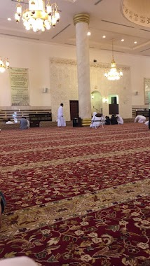
Mosque nearby مسجد الملا
Saudi Arabia
Mosque nearby مسجد الملا
مسجد الملا
3386, Al Fariq, 23333, Jeddah, SA Saudi Arabia
contacts phone
:
+966
Latitude:
21.5485459
, Longitude:
39.1871022
larger map & directions
read more
nearest Mosque
352 m
Mosque
3745 Khaybar, Al Aziziyah District Jeddah 23337 8118 Khaybar, Jeddah
Mosque
read more
391 m
Ihsan Mosque
7761 عبدالله البخاري, حي العزيزية, Jeddah
Mosque
read more
462 m
مسجد عمر بن الخطاب
Al Aziziyah
Mosque
read more
462 m
مسجد عمر بن الخطاب
Aziziyah
Mosque
read more
530 m
Prince Turki bin Khalid Mosque
Alqndeel, Jeddah
Mosque
read more
536 m
Masjid AL Adel
Al Hawwat, Jeddah
Mosque
read more
551 m
Imam Shafi'i mosque
King Fahd Branch Road, Jeddah
Mosque
read more
584 m
مسجد خادم الحرمين الشريفين الملك عبدالله بن عبدالعزيز آل سعود
8541 Wadi Hail, حي العزيزية،, Jeddah
Mosque
read more
589 m
King Abdullah Mosque
8541 Wadi Hail, حي العزيزية،, Jeddah
Mosque
read more
627 m
Masjid Al Amin
Al Muhandisin, Jeddah
Mosque
read more
649 m
Rahma mosque believers
Hasan Yahya, Jeddah
Mosque
read more
666 m
مسجد الزبير بن العوام
7945-7946 Dayar Al Balah, Jeddah
Mosque
read more
706 m
Jihad Mosque
3613 ابار الشيخ, حي مشرفة،, Jeddah
Mosque
read more
749 m
مسجد الحق
Jeddah
Mosque
read more
773 m
مسجد
Abu Qir, Jeddah
Mosque
read more
780 m
Zahra mosque
Abu Qir, Jeddah
Mosque
read more
785 m
مسجد السعداء
3569 Al Mizan, حي مشرفة،, Jeddah
Mosque
read more
786 m
Tawhid Mosque
7972 اطار، حي العزيزية جدة 23337 4158 Itar, Jeddah
Mosque
read more
810 m
Masjid Al Suada
7330 الابار, Mishrifah District, Jeddah
Mosque
read more
848 m
Masjid Al Juhani in Anakesh Mushrefa Jeddah
4056 المغزل, حي مشرفة،, Jeddah
Mosque
read more
881 m
مسجد الخيرات
3599 وادي نجران، حي العزيزية، جدة 23337
Mosque
read more
882 m
مسجد الخيرات
شارع وادي نجران، جدة
Mosque
read more
896 m
مسجد البركة
8908 وادى لؤى، حي العزيزية، جدة 23337
Mosque
read more
910 m
مسجد الصانبي
3074 Al Mizan, Mishrifah District, Jeddah
Mosque
read more
911 m
جامع النور
Wadi Al Hilmi, Jeddah
Mosque
read more
📑
all categories
Accounting
Administrative area level 1
Airport
Amusement park
Aquarium
Art gallery
Atm
Bakery
Bank
Bar
Beauty salon
Bicycle store
Book store
Bowling alley
Bus station
Cafe
Campground
Car dealer
Car rental
Car repair
Car wash
Casino
Cemetery
Church
City hall
Clothing store
Colloquial area
Convenience store
Country
Courthouse
Dentist
Department store
Doctor
Electrician
Electronics store
Embassy
Finance
Fire station
Florist
Food
Funeral home
Furniture store
Gas station
General contractor
Grocery or supermarket
Gym
Hair care
Hardware store
Health
Hindu Temple
Home goods store
Hospital
Insurance agency
Intersection
Jewelry store
Laundry
Lawyer
Library
Light rail station
Liquor store
Local government office
Locality
Locksmith
Lodging
Meal delivery
Meal takeaway
Mosque
Movie rental
Movie theater
Moving company
Museum
Natural feature
Neighborhood
Night club
Painter
Park
Parking
Pet store
Pharmacy
Physiotherapist
Place of worship
Plumber
Point of interest
Police
Political
Post office
Premise
Real estate agency
Restaurant
Roofing contractor
Route
Rv park, camping
School
Shoe store
Shopping mall
Spa
Stadium
Storage
Store
Sublocality
Subpremise
Subway station
Supermarket
Taxi stand
Train station
Transit station
Travel agency
University
Veterinary care
Zoo
sublocality level 1
↑