Mosque nearby Masjid Ghurab مسجد غراب
Saudi Arabia
Mosque nearby Masjid Ghurab مسجد غراب
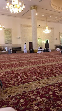
Masjid Ghurab مسجد غراب
Souq Ghurab, Al Aziziyah, Jeddah 23334, Saudi Arabia
contacts phone
:
+966
Latitude:
21.5508586
, Longitude:
39.1759449
larger map & directions
read more
nearest Mosque
313 m
Al Noor Mosque
Al Andalus
Mosque
read more
316 m
مسجد النور
رخاء الإسلام، حي الأندلس، جدة
Mosque
read more
430 m
مسجد الصحابة
Muhammad At Turki, Jeddah
Mosque
read more
486 m
مسجد الإمام محمد بن عبدالوهاب
8819 Uthman Bauthman, حي العزيزية،, Jeddah
Mosque
read more
495 m
مسجد الإمام محمد بن عبدالوهاب
شارع العمرة، حي العزيزية، جدة
Mosque
read more
526 m
مسجد الأميرة طرفة
2477 Saeed Ibn Zaqr, Jeddah
Mosque
read more
715 m
Prince Turki bin Khalid Mosque
Alqndeel, Jeddah
Mosque
read more
738 m
مسجد عمر بن الخطاب
Aziziyah
Mosque
read more
738 m
مسجد عمر بن الخطاب
Al Aziziyah
Mosque
read more
825 m
Masjid Al Amin
Al Muhandisin, Jeddah
Mosque
read more
855 m
Masjid Ummahat ul Momineen
Jeddah
Mosque
read more
894 m
Bugshan Mosque
Al Ashri, Jeddah
Mosque
read more
1.027 km
Mohammed Ibn Abdulaziz Mosque
Ar Rawdah
Mosque
read more
1.027 km
Mohammed Ibn Abdulaziz Mosque
Al Rawdah
Mosque
read more
1.067 km
masjid sarawat
Jeddah
Mosque
read more
1.152 km
مسجد جلالة الملك خالد بن عبدالعزيز آل سعود
2556 Al-Madinah Al-Munawarah Road, حي مشرفة،, Jeddah
Mosque
read more
1.171 km
King Khalid Mosque
Mishrifah
Mosque
read more
1.172 km
مسجد عبد اللطيف جميل
6659 Al-Madinah Al-Munawarah Road, Jeddah
Mosque
read more
1.174 km
Toyota mosque
6551 محمد مجدالدين, حي الفيصلية, Jeddah
Mosque
read more
1.182 km
مسجد الملا
3386 Al Fariq, حي العزيزية, Jeddah
Mosque
read more
1.183 km
Masjid AL Adel
Al Hawwat, Jeddah
Mosque
read more
1.223 km
Imam Shafi'i mosque
King Fahd Branch Road, Jeddah
Mosque
read more
1.24 km
Al faisla masjid
3805 Abu Az Zubayr Al Qurashi, حي الفيصلية،, Jeddah
Mosque
read more
1.285 km
مسجد الحق
Jeddah
Mosque
read more
1.285 km
مسجد مستشفى النساء والولادة بالمساعدية
جدة
Mosque
read more
📑
all categories
Accounting
Administrative area level 1
Airport
Amusement park
Aquarium
Art gallery
Atm
Bakery
Bank
Bar
Beauty salon
Bicycle store
Book store
Bowling alley
Bus station
Cafe
Campground
Car dealer
Car rental
Car repair
Car wash
Casino
Cemetery
Church
City hall
Clothing store
Colloquial area
Convenience store
Country
Courthouse
Dentist
Department store
Doctor
Electrician
Electronics store
Embassy
Finance
Fire station
Florist
Food
Funeral home
Furniture store
Gas station
General contractor
Grocery or supermarket
Gym
Hair care
Hardware store
Health
Hindu Temple
Home goods store
Hospital
Insurance agency
Intersection
Jewelry store
Laundry
Lawyer
Library
Light rail station
Liquor store
Local government office
Locality
Locksmith
Lodging
Meal delivery
Meal takeaway
Mosque
Movie rental
Movie theater
Moving company
Museum
Natural feature
Neighborhood
Night club
Painter
Park
Parking
Pet store
Pharmacy
Physiotherapist
Place of worship
Plumber
Point of interest
Police
Political
Post office
Premise
Real estate agency
Restaurant
Roofing contractor
Route
Rv park, camping
School
Shoe store
Shopping mall
Spa
Stadium
Storage
Store
Sublocality
Subpremise
Subway station
Supermarket
Taxi stand
Train station
Transit station
Travel agency
University
Veterinary care
Zoo
sublocality level 1
↑