Gas station nearby Gas Station
Saudi Arabia
Gas station nearby Gas Station
Gas Station
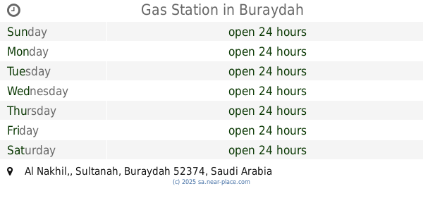
3041, Al Malida, 52547, Buraydah, SA Saudi Arabia
contacts phone
:
+966
Latitude:
26.3284278
, Longitude:
43.8815197
larger map & directions
read more
nearest Gas station
1.785 km
Shayya Gas Station
Buraydah
Gas station
read more
1.834 km
Gas Station
4449 Al Malida, Buraydah
Gas station
read more
2.785 km
Sudairy station
Buraydah
Gas station
read more
3.046 km
Gas Station
3740, 7530, Buraydah
Gas station
read more
3.679 km
Gas Station
Ash Shiqah, Buraydah
Gas station
read more
3.786 km
محطة وقود
2190, 7818, Buraydah
Gas station
read more
3.905 km
محطة القني للخدمات البتروليه
King Salman Road, Buraydah
Gas station
read more
3.913 km
Gas Station
Al Nakhil,, Buraydah
Gas station
read more
4.04 km
Kaz station
2510 Al Hamr Road, Buraydah
Gas station
read more
4.051 km
محطة المبارك للمحروقات والقاز
بريدة
Gas station
read more
4.18 km
محطة ابوايوب
2199 Western Ring Road, Buraydah
Gas station
read more
4.186 km
محطة العطيفي للخدمات البترولية
طريق الملك فيصل، خب الكيفة، بريدة
Gas station
read more
4.241 km
Mohaimeed Gas Station
King Fahd Road, Buraydah
Gas station
read more
4.374 km
محطة جنان النخيل Palm Jinan Station
King Salman Road, Buraydah
Gas station
read more
4.381 km
محطة الاحسان
3030, 7779, Buraydah
Gas station
read more
4.42 km
Al Hammad Station
Buraydah
Gas station
read more
4.458 km
محطة محروقات
2972 طريق الحمر، مشعل بريدة 52372
Gas station
read more
4.462 km
Bilal Station
طريق الحمر Al Hamr Road, Buraydah
Gas station
read more
4.593 km
Gas Station
Al Hamr Road, Buraydah
Gas station
read more
4.675 km
Gas Station
Al Khubaybiyyah, 3844, Buraydah
Gas station
read more
4.691 km
Petrol station
King Fahd Road, Buraydah
Gas station
read more
4.727 km
Java Gas Station
As Salam Road, Buraydah
Gas station
read more
4.945 km
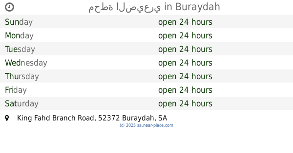
محطة الصيعري
King Fahd Branch Road, Buraydah
Gas station
read more
5.031 km
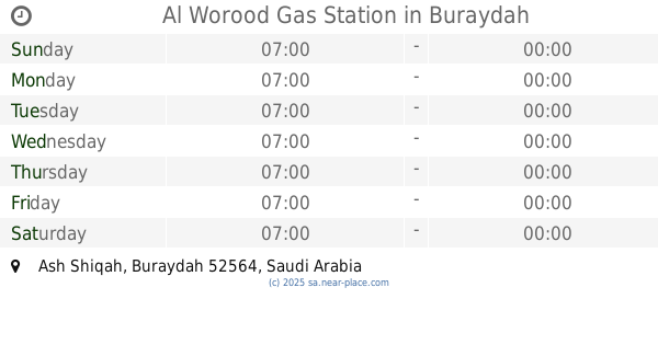
Al Worood Gas Station
Buraydah
Gas station
read more
5.372 km
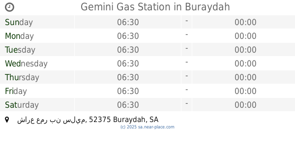
Gemini Gas Station
شارع عمر بن سليم, Buraydah
Gas station
read more
📑
all categories
Accounting
Administrative area level 1
Airport
Amusement park
Aquarium
Art gallery
Atm
Bakery
Bank
Bar
Beauty salon
Bicycle store
Book store
Bowling alley
Bus station
Cafe
Campground
Car dealer
Car rental
Car repair
Car wash
Casino
Cemetery
Church
City hall
Clothing store
Colloquial area
Convenience store
Country
Courthouse
Dentist
Department store
Doctor
Electrician
Electronics store
Embassy
Finance
Fire station
Florist
Food
Funeral home
Furniture store
Gas station
General contractor
Grocery or supermarket
Gym
Hair care
Hardware store
Health
Hindu Temple
Home goods store
Hospital
Insurance agency
Intersection
Jewelry store
Laundry
Lawyer
Library
Light rail station
Liquor store
Local government office
Locality
Locksmith
Lodging
Meal delivery
Meal takeaway
Mosque
Movie rental
Movie theater
Moving company
Museum
Natural feature
Neighborhood
Night club
Painter
Park
Parking
Pet store
Pharmacy
Physiotherapist
Place of worship
Plumber
Point of interest
Police
Political
Post office
Premise
Real estate agency
Restaurant
Roofing contractor
Route
Rv park, camping
School
Shoe store
Shopping mall
Spa
Stadium
Storage
Store
Sublocality
Subpremise
Subway station
Supermarket
Taxi stand
Train station
Transit station
Travel agency
University
Veterinary care
Zoo
sublocality level 1
↑