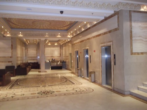
Lodging nearby Ezzy Makan (Emarrat Ezzy)
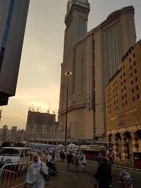
Saudi Arabia
Lodging nearby Ezzy Makan (Emarrat Ezzy)
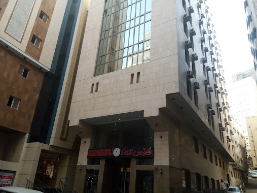
Ezzy Makan (Emarrat Ezzy)
Ajyad, Mecca 24231, Saudi Arabia
contacts phone
:
+966 12 574 8727
website:
www.sigatulhaj.org
Latitude:
21.4152618
, Longitude:
39.8296552
larger map & directions
read more
nearest Lodging
10 m
All seasons Hotel
Kuday Ajyad Tunnels, Mecca
Lodging
read more
13 m
روابي الصلاح
Kuday Ajyad Tunnels, Mecca
Lodging
read more
19 m
وقف طاهرة بنت كريم بخش المصافي
أجياد، مكة
Lodging
read more
22 m
فندق صرح المنامة 5
2 5N، مكة
Lodging
read more
41 m
فندق قصر زوار البيت
6, 21°24'56.0"N 39°49'47.
Lodging
read more
43 m
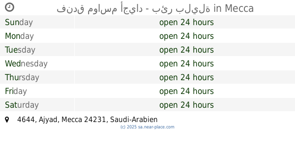
فندق مواسم أجياد - بئر بليلة
4644, Mecca
Lodging
read more
45 m
فندق صفوة اجياد ٢
Ajyad
Lodging
read more
49 m
فندق جوهرة البيت
3 5N، Pomacochas
Lodging
read more
51 m
فندق صفوة اجياد ٣
6472, Mecca
Lodging
read more
54 m
Durrat Al Masafi Hotel
Kuday Ajyad Tunnels, Ajyad Al Masafi, Mecca
Lodging
read more
69 m
Rawabi Syamikh Hotel
6528, Mecca
Lodging
read more
81 m
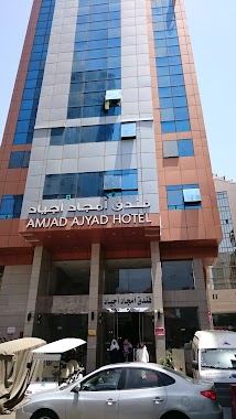
Amjad Ajyad Hotel
اجياد المصافي, Mecca
Lodging
read more
85 m
Jawharat Al Bait Hotel
Al Masafi 4644, Mecca
Lodging
read more
87 m
Hotel Nginap Di Mekkah
Mecca
Lodging
read more
97 m
فندق جوهرة المصافي
6469, Mecca
Lodging
read more
110 m
Zwar Al Bait Hotel
First Ring Road, Mecca
Lodging
read more
110 m
Oulayan Ajyad Hotel
Ajyad Street, Mecca
Lodging
read more
110 m
فندق الجوهره
Unnamed Road, Mecca
Lodging
read more
110 m
فندق روابي الشامخ 2
4667، أجياد، مكة 24231
Lodging
read more
112 m
Ajiad seasons A
نفق ريع بخش, Mecca
Lodging
read more
112 m
Hotel Mavasam Ajyad
4604, Mecca
Lodging
read more
112 m
فندق مواسم أجياد ب
4 5N، Pomacochas
Lodging
read more
123 m
ALFAJAR ALBADYA 2 HOTEL
Ajyad Street, أجياد المصافي, Mecca
Lodging
read more
127 m
Rawabi Shamikh Hotel
Ajyad, Mecca
Lodging
read more
133 m
الحبيبة مكة
4706, Mecca
Lodging
read more
📑
all categories
Accounting
Administrative area level 1
Airport
Amusement park
Aquarium
Art gallery
Atm
Bakery
Bank
Bar
Beauty salon
Bicycle store
Book store
Bowling alley
Bus station
Cafe
Campground
Car dealer
Car rental
Car repair
Car wash
Casino
Cemetery
Church
City hall
Clothing store
Colloquial area
Convenience store
Country
Courthouse
Dentist
Department store
Doctor
Electrician
Electronics store
Embassy
Finance
Fire station
Florist
Food
Funeral home
Furniture store
Gas station
General contractor
Grocery or supermarket
Gym
Hair care
Hardware store
Health
Hindu Temple
Home goods store
Hospital
Insurance agency
Intersection
Jewelry store
Laundry
Lawyer
Library
Light rail station
Liquor store
Local government office
Locality
Locksmith
Lodging
Meal delivery
Meal takeaway
Mosque
Movie rental
Movie theater
Moving company
Museum
Natural feature
Neighborhood
Night club
Painter
Park
Parking
Pet store
Pharmacy
Physiotherapist
Place of worship
Plumber
Point of interest
Police
Political
Post office
Premise
Real estate agency
Restaurant
Roofing contractor
Route
Rv park, camping
School
Shoe store
Shopping mall
Spa
Stadium
Storage
Store
Sublocality
Subpremise
Subway station
Supermarket
Taxi stand
Train station
Transit station
Travel agency
University
Veterinary care
Zoo
sublocality level 1
↑