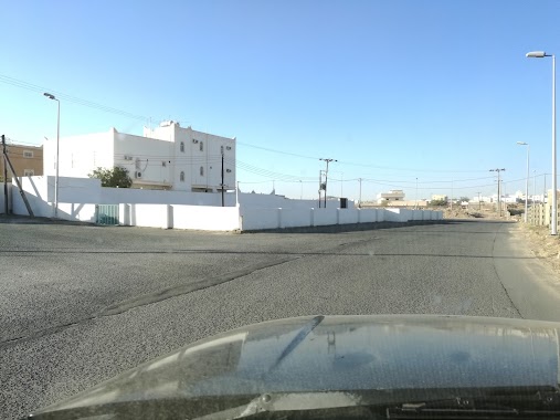
Mosque nearby جامع مبارك بن بدي
Saudi Arabia
Mosque nearby جامع مبارك بن بدي
جامع مبارك بن بدي
Saudi Arabia
contacts phone
:
+966
Latitude:
18.2423716
, Longitude:
42.7293019
larger map & directions
read more
nearest Mosque
2.022 km
Mosque Mubarak bin Said bin intruder
2860, Khamis Mushait
Mosque
read more
2.087 km
جامع حي الريان
Khamis Mushait
Mosque
read more
2.158 km
مسجد فهد بن سيّاح
Khamis Mushait
Mosque
read more
2.374 km
Ansar Mosque
4668, Khamis Mushait
Mosque
read more
2.423 km
جامع عمر بن عبدالعزيز
8755, Khamis Mushait
Mosque
read more
2.574 km
Masjid Al Moghaidh neighborhood Zlalh
8070, Khamis Mushait
Mosque
read more
2.67 km
مسجد
8376, 3531, Khamis Mushait
Mosque
read more
2.938 km
مسجد أم محمد بن زحيفة
طريق المدينة العسكرية- حي ذهبان، خميس مشيط
Mosque
read more
2.942 km
Othman bin Mazon Mosque
3755, Khamis Mushait
Mosque
read more
3.069 km
Suhaib Rumi Mosque
Mosque
read more
3.137 km
مسجد
15, Khamis Mushait
Mosque
read more
3.137 km
مسجد معاذ بن جبل
3749 South to Ahad Rufaiydah Northern to Khamis Mushayt, Khamis Mushait
Mosque
read more
3.262 km
مسجد هيف
7403, Khamis Mushait
Mosque
read more
3.436 km
مسجد زيد بن الخطاب
حي عتود، خميس مشيط
Mosque
read more
3.447 km
مسجد بلال ابن رباح
8070, Khamis Mushait
Mosque
read more
3.465 km
مسجد الوالدين
4285 جنوبا الى احد رفيده و شمالا الى خميس مشيط, Khamis Mushait
Mosque
read more
3.474 km
Mosque Almtoklh girl Massoud
2847, Khamis Mushait
Mosque
read more
3.507 km
Eid prayer neighborhood Dhahban
7214, Khamis Mushait
Mosque
read more
3.509 km
Khamis Mosque General Hospital
8022 South to Ahad Rufaiydah Northern to Khamis Mushayt, Khamis Mushait
Mosque
read more
3.525 km
جامع عبدالملك بن مروان
4397, Khamis Mushait
Mosque
read more
3.555 km
Healing neighborhood mosque
طريق الأمير سلطان, Khamis Mushait
Mosque
read more
3.585 km
مسجد السعيد
15, Khamis Mushait
Mosque
read more
3.606 km
مسجد ابن مشيط
15, Khamis Mushait
Mosque
read more
3.613 km
مسجد الوالدين عتود العماير
Saudi Arabia
Mosque
read more
3.614 km
جامع بن رابعه بالهرير
7514, Khamis Mushait
Mosque
read more
📑
all categories
Accounting
Administrative area level 1
Airport
Amusement park
Aquarium
Art gallery
Atm
Bakery
Bank
Bar
Beauty salon
Bicycle store
Book store
Bowling alley
Bus station
Cafe
Campground
Car dealer
Car rental
Car repair
Car wash
Casino
Cemetery
Church
City hall
Clothing store
Colloquial area
Convenience store
Country
Courthouse
Dentist
Department store
Doctor
Electrician
Electronics store
Embassy
Finance
Fire station
Florist
Food
Funeral home
Furniture store
Gas station
General contractor
Grocery or supermarket
Gym
Hair care
Hardware store
Health
Hindu Temple
Home goods store
Hospital
Insurance agency
Intersection
Jewelry store
Laundry
Lawyer
Library
Light rail station
Liquor store
Local government office
Locality
Locksmith
Lodging
Meal delivery
Meal takeaway
Mosque
Movie rental
Movie theater
Moving company
Museum
Natural feature
Neighborhood
Night club
Painter
Park
Parking
Pet store
Pharmacy
Physiotherapist
Place of worship
Plumber
Point of interest
Police
Political
Post office
Premise
Real estate agency
Restaurant
Roofing contractor
Route
Rv park, camping
School
Shoe store
Shopping mall
Spa
Stadium
Storage
Store
Sublocality
Subpremise
Subway station
Supermarket
Taxi stand
Train station
Transit station
Travel agency
University
Veterinary care
Zoo
sublocality level 1
↑