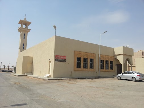
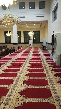
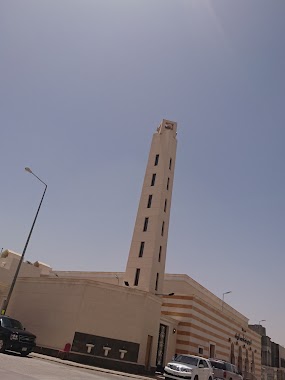
Mosque nearby مسجد الجوهرة العجمي
Saudi Arabia
Mosque nearby مسجد الجوهرة العجمي
مسجد الجوهرة العجمي
King Abdul Aziz Branch Road, 13325, Riyadh, SA Saudi Arabia
contacts phone
:
+966
Latitude:
24.8290252
, Longitude:
46.6373277
larger map & directions
read more
nearest Mosque
237 m
مسجد الإمامين البخاري ومسلم
2425, 7205, Riyadh
Mosque
read more
293 m
Sheikh Hamad Al Hammadi Mosque
رقم 202, Riyadh
Mosque
read more
347 m
مسجد سارة الجماز
4190, 8425, Riyadh
Mosque
read more
356 m
Hme girl Sindh Ali mosque
No. 272, 8096, Riyadh
Mosque
read more
358 m
مسجد السند
3980, 8096, Riyadh
Mosque
read more
425 m
Sheikh Hamoud bin Mohammed Hamoud Mosque
No. 306, Riyadh
Mosque
read more
506 m
مسجد الشيخ فهد الشثري
3903, Riyadh
Mosque
read more
577 m
Saleh Bin Abdul Rahman Al Obailan Mosque
2641, 7501, Riyadh
Mosque
read more
581 m
Masjid Al-Hajri
7535, Riyadh
Mosque
read more
617 m
مسجد عبدالله الحقيل
King Salman Road, Riyadh
Mosque
read more
651 m
Suleiman bin Mohammed Mosque Hammali
Riyadh
Mosque
read more
663 m
جامع منيرة ال الشيخ
2823, 6864, Riyadh
Mosque
read more
756 m
Salim Sulaiman Al-Ahmad mosque
Riyadh
Mosque
read more
864 m
مسجد والدة عبدالعزيز وإبراهيم الشايع
No. 135, Riyadh
Mosque
read more
869 m
مسجد والدة سعد الحقان
Riyadh
Mosque
read more
873 m
Safa Mosque
Riyadh
Mosque
read more
884 m
Abdullah Bin Jebreen Masjed
Ar Radif, Riyadh
Mosque
read more
891 m
جامع سلطان بن حمد السلطان
7104 Al Nafl, Riyadh
Mosque
read more
982 m
مسجد ودار فاطمة الشقحاء
No. 171, Riyadh
Mosque
read more
1.016 km
مسجد حديقة الياسمين
Riyadh
Mosque
read more
1.056 km
مسجد الجوهرة بنت أحمد المرشد
3271, Riyadh
Mosque
read more
1.077 km
Ruqaya Al Daba'an Masjed
3330, Riyadh
Mosque
read more
1.087 km
مسجد الياسمين
Al Yasmin
Mosque
read more
1.125 km
مسجد خالد بن الوليد رضي الله عنه
7049, 3919, Riyadh
Mosque
read more
1.146 km
Um Ibrahim Sultan Masjed
Prince Abdullah Bin Saud Bin Abdullah Snatan Al Saud, Riyadh
Mosque
read more
📑
all categories
Accounting
Administrative area level 1
Airport
Amusement park
Aquarium
Art gallery
Atm
Bakery
Bank
Bar
Beauty salon
Bicycle store
Book store
Bowling alley
Bus station
Cafe
Campground
Car dealer
Car rental
Car repair
Car wash
Casino
Cemetery
Church
City hall
Clothing store
Colloquial area
Convenience store
Country
Courthouse
Dentist
Department store
Doctor
Electrician
Electronics store
Embassy
Finance
Fire station
Florist
Food
Funeral home
Furniture store
Gas station
General contractor
Grocery or supermarket
Gym
Hair care
Hardware store
Health
Hindu Temple
Home goods store
Hospital
Insurance agency
Intersection
Jewelry store
Laundry
Lawyer
Library
Light rail station
Liquor store
Local government office
Locality
Locksmith
Lodging
Meal delivery
Meal takeaway
Mosque
Movie rental
Movie theater
Moving company
Museum
Natural feature
Neighborhood
Night club
Painter
Park
Parking
Pet store
Pharmacy
Physiotherapist
Place of worship
Plumber
Point of interest
Police
Political
Post office
Premise
Real estate agency
Restaurant
Roofing contractor
Route
Rv park, camping
School
Shoe store
Shopping mall
Spa
Stadium
Storage
Store
Sublocality
Subpremise
Subway station
Supermarket
Taxi stand
Train station
Transit station
Travel agency
University
Veterinary care
Zoo
sublocality level 1
↑