School nearby Eng Mohammad Complex
Saudi Arabia
School nearby Eng Mohammad Complex
Eng Mohammad Complex
حي البشائر، Al Bashaer, Jeddah 23781 8862, Saudi Arabia
contacts phone
:
+966
Latitude:
21.8097311
, Longitude:
39.1743647
larger map & directions
read more
nearest School
112 m
مدرسة ساره
4064, حي البشائر،, Jeddah
School
read more
177 m
المتوسطة السابعة عشر بعد المئه
Jeddah
School
read more
188 m
الابتدائية السادسة والعشرون
Jeddah
School
read more
196 m
El Bashayer schools
21°48'39.7"N 39°10'23.1"E
School
read more
221 m
مجمع مدارس البنات بالبشاير
Jeddah
School
read more
225 m
المدرسة ٢٦ الإبتدائية للبنات
Jeddah
School
read more
274 m
الثانوية العاشرة بعد المئة
Jeddah
School
read more
1.973 km
مدارس البشائر
4638, حي البشائر،, Jeddah
School
read more
2.305 km
مدارس النصر الاهلية
Jeddah
School
read more
2.333 km
مجمع مدارس النصر الاهليه
Jeddah
School
read more
2.338 km
مدارس النصر الاهليه - بنين فرع طيبه
Jeddah
School
read more
2.529 km
Forum School for young civil
Wahab bin Khuwaylid, Jeddah
School
read more
2.729 km
masjed alwaldain
Unnamed Road, Jeddah
School
read more
2.853 km
دار وروضه براعم الرحمن
Unnamed Road, Jeddah
School
read more
2.998 km
روضة الحمدانية
Unnamed Road, Jeddah
School
read more
3.043 km
روضة جيل العزم
Jeddah
School
read more
3.178 km
دار رملة بنت ابي سفيان رضي الله عنها
3819 حي طيبة، جدة 23831 7724،
School
read more
3.178 km
دار رملة بنت ابي سيفان
3819 حي طيبة، جدة 23831 7724،
School
read more
3.211 km
المدرسة ١٧٣ بنات و٢٦
Jeddah
School
read more
3.26 km
المدرسة الثالثة والسبعون بعد المائة الإبتدائية بنات ١٧٣
Jeddah
School
read more
3.262 km
112 medium
معمر بن حارث, Jeddah
School
read more
3.275 km
Girls Schools Complex
Taiba
School
read more
3.279 km
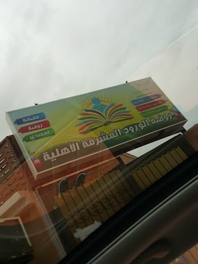
روضة الورود المشرقة الأهليه
سليمان بن جعفر, Jeddah
School
read more
3.283 km
Tyba MPh
Jeddah
School
read more
3.296 km
المتوسطة الثانية عشر بعد المائة بنات ١١٢
Jeddah
School
read more
📑
all categories
Accounting
Administrative area level 1
Airport
Amusement park
Aquarium
Art gallery
Atm
Bakery
Bank
Bar
Beauty salon
Bicycle store
Book store
Bowling alley
Bus station
Cafe
Campground
Car dealer
Car rental
Car repair
Car wash
Casino
Cemetery
Church
City hall
Clothing store
Colloquial area
Convenience store
Country
Courthouse
Dentist
Department store
Doctor
Electrician
Electronics store
Embassy
Finance
Fire station
Florist
Food
Funeral home
Furniture store
Gas station
General contractor
Grocery or supermarket
Gym
Hair care
Hardware store
Health
Hindu Temple
Home goods store
Hospital
Insurance agency
Intersection
Jewelry store
Laundry
Lawyer
Library
Light rail station
Liquor store
Local government office
Locality
Locksmith
Lodging
Meal delivery
Meal takeaway
Mosque
Movie rental
Movie theater
Moving company
Museum
Natural feature
Neighborhood
Night club
Painter
Park
Parking
Pet store
Pharmacy
Physiotherapist
Place of worship
Plumber
Point of interest
Police
Political
Post office
Premise
Real estate agency
Restaurant
Roofing contractor
Route
Rv park, camping
School
Shoe store
Shopping mall
Spa
Stadium
Storage
Store
Sublocality
Subpremise
Subway station
Supermarket
Taxi stand
Train station
Transit station
Travel agency
University
Veterinary care
Zoo
sublocality level 1
↑